|
USA
MAINE�S
EASY 18 LIGHTHOUSES
by Ken
Rudine
Photographs by the author |
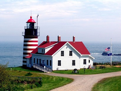
| West Quoddy
Lighthouse near Lubec, Maine |
The
Kancamagus Highway brought us down from the higher elevations
of the White Mountains. The trees became greener as if spring
was happening just as we past. We came upon a tourist info center
as we reached the Maine border. The helpful attendant mentioned that
just up the road is where �that car� hit Stephen King. Fortified
with local trivia and maps, we advanced into unknown territory.
The plan was to start in the north at Calais on the St. Croix River
and then finish in the south heading back to Texas.
We followed the water to find West Quoddy Lighthouse near Lubec.
It is our country�s farthest north and east point; they call this
area �Down East�. Located at latitude of ~45 degrees, half-way between
the equator and the North Pole influences the tides which are 20 to
28 feet. When day was done, from our room at Machitas we watched the
tide go out. Maybe 18 hours later, when we left, it was still out.
While at Bar Harbor we drove the 27-mile scenic road in
Acadia National Park. Reading about this area stated that Longfellow
never visited the Acadian area of Louisiana. That pretty well challenges
what I learned six decades ago about the Evangeline Oak and Longfellow�s
home in the Bayou Teche country. (See Evangeline)
At Rockland we were told a story about the light keeper�s Springer
Spaniel named Spot. The dog was trained to pull the rope sounding
the fog bell when he became aware of a boat approaching. Boats would
answer with a whistle or bell and Spot would bark.
Pemaquid Point, one of the lights seen the next day, greeted
us with blooming Lupines growing on the side of the road reminding
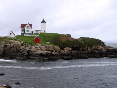
us of spring and Texas Bluebonnets. Three days later photographing
Cape Neddick, where a wedding party was posing for photos,
we were met with 55 degrees and a 55 MPH wind. Reminding us we are
still 2400 miles northeast of Texas. |
MAINE LIGHTHOUSES:
Our visitation
order:
West Quoddy,
Lubec Channel Light,
Egg Rock,
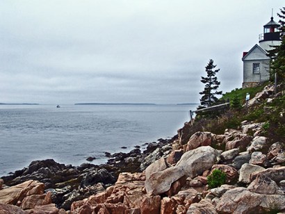
Bass Harbor,
Dyce Head,
Fort Point,
Rockland Breakwater,
Owls Head,
Marshall Point,
Pemiquid Point,
Doubling Point,
Spring Point Ledge,
Portland Breakwater,
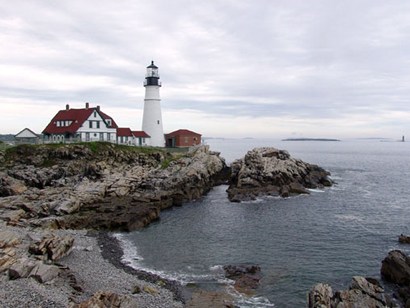
Portland Head,
Ram Island Ledge,
Cape Elizabeth,
Cape Neddick and
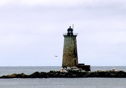
Whaleback.
Traveling
Maine? Book Hotel Here |
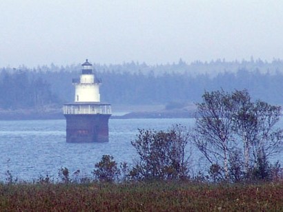
Lubec Channel
Light, Lubec -
Typical of a lighthouse style aka "Sparkplug" Light |
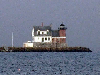
| Rockland Breakwater,
Rockland Harbor |
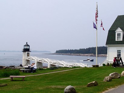
| Marshall Point,
Port Clyde |
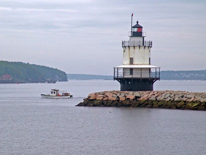
| Spring Point
Ledge, South Portland |
| Portland Head,
Cape Elizabeth |
Following Maine
maps and signs can be difficult so after this trip we bought a GPS
which we now always use. We recommend you use a GPS to find these
lighthouses. For your convenience the coordinates of each light can
be found at http://www.etravelmaine.com/activities/maine_lighthouses.htm
© Ken
Rudine,
Published
July 22, 2009
Traveling
Maine? Book Hotel Here |
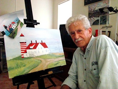
| Leo Magni, is
a Rockport neighbor who is a talented artist working in oils. Here
Leo shows his work-in-progress painting of my West Quoddy, that has
since been finished and sold. |
|
|