|
| On
this day we woke up in Kayenta, AZ and drove Hwy 163 to
Monument Valley. Due to a
huge dust storm our visit to Monument
Valley turned out to be not all we hoped it to be. It was
an easy decision to decide to move on to �greener pastures� or as
might be said around here - REDder ROCKS. When planning our trip I
found a nearby place called Valley of the Gods, an unrestricted
Monument Valley, if you will. |
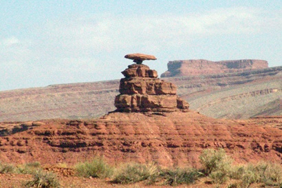
Mexican Hat rock
viewed from Hwy 163
Photo courtesy Ken
Rudine |
| Mexican
Hat is a wide spot in the road in southeast
Utah
and the gateway to the Valley of the Gods. After seeing the valley
our intention was to go to Hanksville for the night. We entered the
Valley of the Gods from Hwy 163 that also gives you a good
view of the Mexican Hat rock, a rock that looks like a Sombrero, upside
down on top of a mountain. |
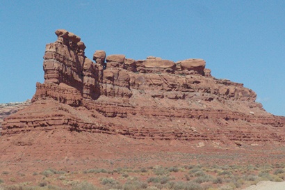
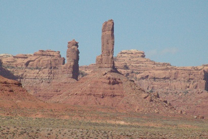
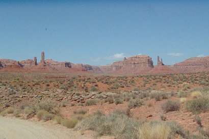
| The Valley
road is gravel and is a left turn, 8 miles north on Hwy 163. Seventeen
miles long, it offers spectacular close-up views of cliffs, buttes,
pinnacles and other unusually shaped red rocks. Our travel time on
this road was 1 hour and 7 minutes. We stopped several times to take
photos and we were behind a road maintainer for 5 minutes. You do
the math to know how long it would take for your trip. |
 |
A standard vehicle
is suitable for this road, but you can kiss your carwash goodbye.
Two cars can pass on this road but the smoothness varies causing our
speed to alternate from 10 to 40mph. I would not drive it with an
RV or pull a trailer of any kind. Large boulders are along each side
of the road since a maintainer keeps it graded. We only met 4 cars
on the entire length of the road, but our time behind the road grader
seemed like forever.
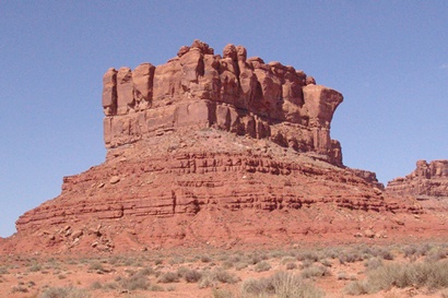
Some rock formations have names. A partial listing from our entrance
includes Scotchman Butte (still on 163) then on the gravel
road is Sitting Hen Butte, Battleship Rock, Castle Butte, according
to a posting on a bulletin board. |
Gravel road climbing
Cedar Mesa
Photo courtesy Ken
Rudine |
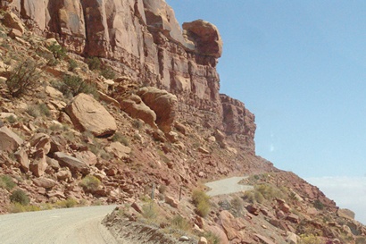
| Upon
completing the valley trip we exit on Hwy 261 on the west.
Near our exit is a bed and breakfast, appropriately named. Here a
left turn takes you back to Mexican Hat whereas a right turn takes
you north on Hwy 261, which took us to the top of Cedar Mesa.
This is a dangerously exciting gravel road utilizing switchbacks to
climb the 1200 foot mesa in 3 miles taking 15minutes. This is called
the Moki Dugway. It reminded me of the Caprock around Dickens,
Texas. |
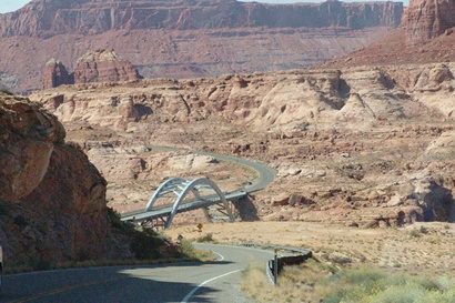
Highway 95 bridge
over Colorado River
Photo courtesy Ken
Rudine |
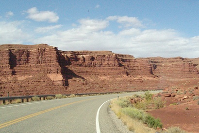
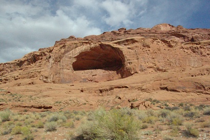
| For hikers (which
we are not) Cedar Mesa is known for scenic canyons and Anasazi
ruins and rock art. Once on Cedar Mesa, Hwy 261 eventually
meets Hwy 95 where we turned in a northwesterly direction and
later crossing the joining of the Colorado and Dirty Devil Rivers,
which forms Lake Powell to the south. This is a shockingly
scenic road that continues on to Hanksville. |
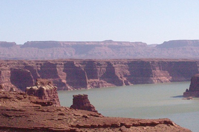
Lake Powell at
Highway 95 bridge area
Photo courtesy Ken
Rudine |
South of Hanksville
on Highway 95
Photo courtesy Ken
Rudine |
West of Hanksville
on Highway 24
Photo courtesy Ken
Rudine |
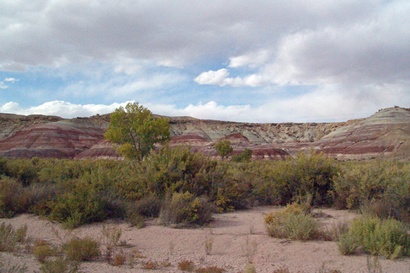
| The problem is
Hanksville is shockingly inadequate as a place to eat and spend a
night. So we had to continued west on Hwy 24 to Torrey. This
highway follows the scenic Fremont River across Capitol Reef.
Unintentionally we had traveled 264 miles on this day. |
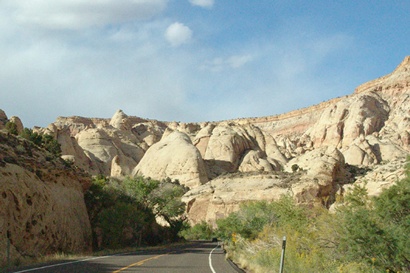
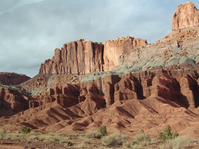
Crossing Capitol
Reef on Highway 24
Photo courtesy Ken
Rudine |
Crossing Capitol
Reef on Highway 24
Photo courtesy Ken
Rudine |
| At Torrey
we did find a comfortable motel with a good restaurant and a chance
to recharge our body and souls. |
|
|