|
In
search of covered bridges along our path, we entered Vermont
the Green Mountain State at Fair Haven continuing on to Rutland,
VT our destination on this day late in the month of May. There
could have been good photos to be made along the way, but we were
greeted with only rain.
As we left Rutland the next morning heading toward Killington
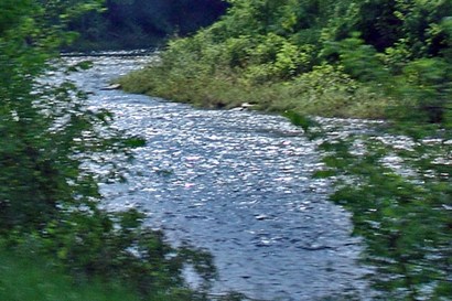
things looked very pretty. Passing near the small town of Brandon
we came to the quaint town of Bridgewater, where a stream ran
along the side of the road. The stream sparkled like diamonds in a
shaft of sunlight reminding us of sparkling water.
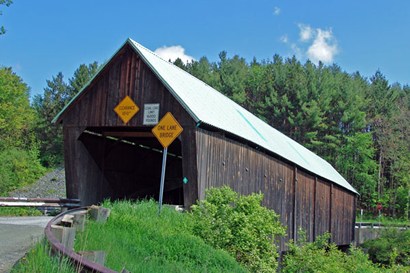
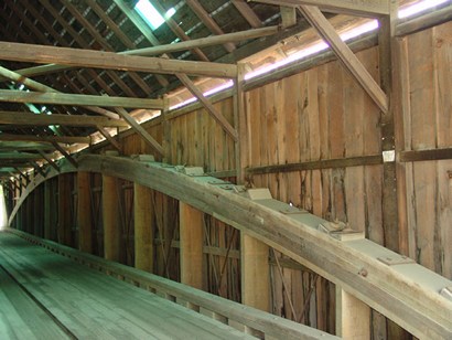
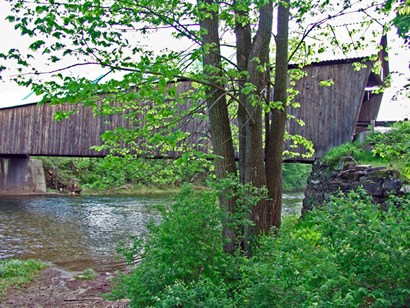
Our first stop was the Lincoln Covered Bridge near Woodstock
that crossed the Quechee River. While making photos a meadowlark
sang its song for our enjoyment. We had passed in the town about 10:30,
just as the towns people were lining the streets to be spectators
of the soon to pass Memorial Day parade. We were almost trapped into
being part of it. |
| Lincoln Covered
Bridge interior |
| Lincoln Covered
Bridge over the Quechee River |
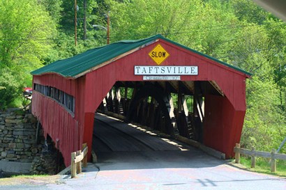
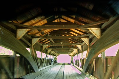
| We moved on to
Taftsville Covered Bridge over the Ottauqueche River
past the hydroelectric power station. This is the oldest bridge in
Windsor County and Vermont ranks it fourth among the surviving wooden
truss spans. It appears to be heavily traveled. Here we also spotted
many yellow and black butterflies. |
| Taftsville Covered
Bridge |
| Taftsville Covered
Bridge interior |
| Near
Sugar Bush farms we stopped to see a film on how Maple trees
are tapped to extract the liquid that is cooked down into maple syrup.
If you have ever seen Ribbon Cane Syrup cooked around Rusk
TX, you won�t see much difference cooking maple syrup. In 1964
Roger Miller found a need to call it �Surple� as he wrote �Dang Me�
in just 4 minutes. In a burst of brilliance he came up with �surple�
to rhyme with purple. Dang Me stayed on the Billboard charts for half
a year. |
Dang me, dang
me
They oughta take a rope and hang me
High from the highest tree
Woman would you weep for me.
Roses are red and violets are purple
Sugar is sweet and so is maple surple
I was the seventh out of seven sons
My pappy was a pistol
I'm a son of a gun. |
On a hillside
we saw cutout figures at (what looked like) a nursery called �Fool
on the Hill.� Actually a closer look allowed us to see it was a simple
tourist trap, so we continued on. It was noticeable because this State
is all trees and streams and almost no signs are allowed.
In a few miles we came to the Quechee Gorge, which according
to what little we could see, was spectacular. Many people were lined
up on the bridge taking photos.
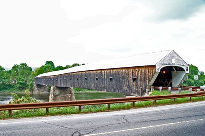
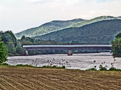
After stopping at the Hartford Vermont Welcome Center we headed
for the Cornish Windsor Covered Bridge the longest such bridge.
At the bridge, upon leaving the west bank to cross the Connecticut
River, you simultaneously leave Vermont. The river and the other side
belong to the State of New
Hampshire. Windsor is where Vermont
was founded in 1777. |
| Cornish Windsor
Covered Bridge - the longest such bridge |
| Cornish Windsor
Covered Bridge over the Connecticut River |
| We snacked for
lunch at an insect infested rest stop near Brookfield. For
the next hour and a half we tried in vain to find a hotel with Queen
sized beds. Apparently when the locals get large, perhaps they move
to Florida. After we tried the Inns in Barre, VT, and Montpelier we
settled for the usual double beds. Overnight, we stayed in Barre,
the so called �Granite Center of the World.� |
| Highway 302 easterly
from Barre |
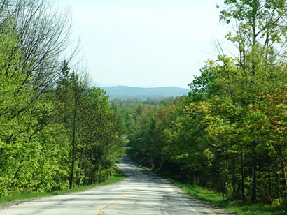
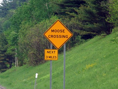
| The next morning
dawned veiled in heavy fog so first we filled our gas tank. As we
drove easterly along Hwy 302, the weather cleared up almost immediately.
We saw more moose signs and floating fuzzes in the air, likely from
area cottonwood trees. We passed Groton State Forest and in
the town we saw a couple of signs that said �Take Back Vermont�. |
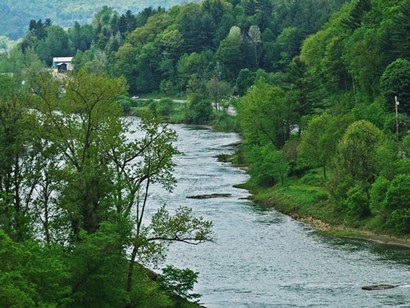
| We
passed through Ryegate, VT where a stream began running beside
us, first on the right side of the road � and then left. Around Wells
River many roadside flea markets entertained us for a few miles.
The wilderness began encroaching on our views giving me a feeling
I could write a ghost story, named �The Bridge Uncovered�. Nah, I
will need more signs, Oh well. |
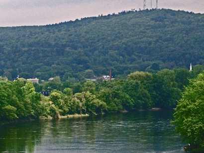
| Near the junction
of the White and Connecticut Rivers |
| Suddenly we realized
we had left Vermont
somewhere back in the trees. No road markers, of course. Franconia
Notch, NH here we come. |
|
|