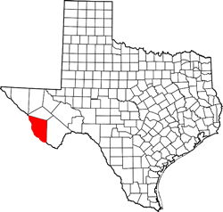
TexasEscapes.com HOME Welcome to Texas Escapes
A magazine written by Texas
Custom Search
New   |   Texas Towns   |   Ghost Towns   |   Counties   |   Trips   |   Features   |   Columns   |   Architecture   |   Images   |   Archives   |   Site Map

Presidio County TX
Presidio County

Counties
Texas Counties


Texas Towns
A - Z

Alpine Hotels

More Hotels


ALAMITO, TEXAS


Texas Ghost Town
Presidio County, West Texas

FM 169
On Alamito Creek
31 miles S of Marfa

Historical Marker:
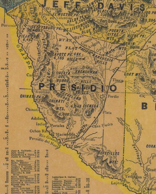
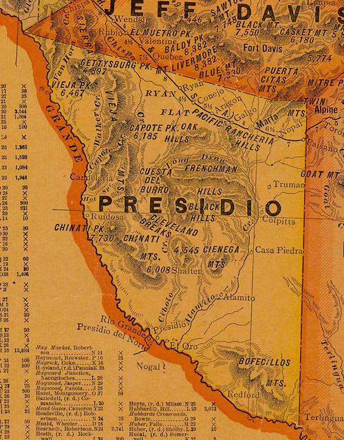
7 miles S of Marfa on US 67, then 24 miles S on FM 169 to Alamito Creek

Site of Alamito

Alamito Creek has been a passageway and the scene of human activity since prehistoric times. Spanish explorers began traveling through the region in 1535. Mexican families began to settle in the area about 1715 and established rancheros despite an Apache presence. Beginning in the 1850s, the infamous Chihuahua Trail, a route for heavy freight wagons from San Antonio to Chihuahua, Mexico, passed near Alamito. By 1870 Alamito was a community with several families farming and working on nearby ranches.

John Davis, a pioneer from North Carolina, was a strong community leader. He married Francisca Herrera, the daughter of Carlos Herrera, one of the first Spanish settlers of Alamito, in 1875. They built a home with a chapel, one-room school, and a canal for crop irrigation. Davis was known for serving peach brandy to weary travelers who came through on the Chihuahua Trail. Francisca died in 1892 and was buried near the chapel in Alamito. The grief-stricken Davis went back to North Carolina and never returned to this area.

he legendary railroad known as the "Road to Topolabampo" was the result of a longtime dream of A. E. Stilwell, railroad builder and urban promoter, for a rail line from Kansas City to Mexico's west coast. It passed through Alamito in 1930. The Railroad dug a deep well, constructed a tank to water the steam engines, built a section house for workers, and renamed the site Plata. At the end of the 20th century, only ruins of the Davis-Herrera home, school, cemetery and canal remain. Ruts of the Chihuahua Trail can still be seen in the bedrock north of Alamito.
(2000)

Presidio County TX 1920 Map
Presidio County 1920s map showing Alamito Creek, Alamito, Casa Piedra, Marfa & more
From Texas state map #10749
Courtesy Texas General Land Office


Presidio County TX 1940s Map
Presidio County 1940s Map showing Alamito Creek, Plata, Casa Piedra, Marfa & more
Courtesy Texas General Land Office

Take a road trip

West Texas

Alamito, Texas Nearby Towns:
Marfa the county seat
Fort Davis
Alpine
Van Horn
See Presidio County

Book Hotel Here:
Alpine Hotels | More Hotels
Texas Escapes, in its purpose to preserve historic, endangered and vanishing Texas, asks that anyone wishing to share their local history, stories, landmarks and recent or vintage photos, please contact us.


Texas Escapes Online Magazine »   Archive Issues » Home »
TEXAS TOWNS & COUNTIES TEXAS LANDMARKS & IMAGES TEXAS HISTORY & CULTURE TEXAS OUTDOORS MORE
Texas Counties
Texas Towns A-Z
Texas Ghost Towns

TEXAS REGIONS:
Central Texas North
Central Texas South
Texas Gulf Coast
Texas Panhandle
Texas Hill Country
East Texas
South Texas
West Texas

Courthouses
Jails
Churches
Schoolhouses
Bridges
Theaters
Depots
Rooms with a Past
Monuments
Statues

Gas Stations
Post Offices
Museums
Water Towers
Grain Elevators
Cotton Gins
Lodges
Stores
Banks

Vintage Photos
Historic Trees
Cemeteries
Old Neon
Ghost Signs
Signs
Murals
Gargoyles
Pitted Dates
Cornerstones
Then & Now

Columns: History/Opinion
Texas History
Small Town Sagas
Black History
WWII
Texas Centennial
Ghosts
People
Animals
Food
Music
Art

Books
Cotton
Texas Railroads

Texas Trips
Texas Drives
Texas State Parks
Texas Rivers
Texas Lakes
Texas Forts
Texas Trails
Texas Maps
USA
MEXICO
HOTELS

Site Map
About Us
Privacy Statement
Disclaimer
Contributors
Staff
Contact Us

 
Website Content Copyright Texas Escapes LLC. All Rights Reserved