|
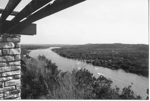
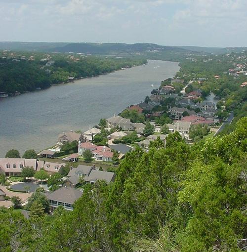
View of Lake
Austin from Mount Bonnell
Photo
Courtesy of Chandra Moira Beal |
LAKE AUSTIN
Excerpted from
Splash
Across Texas by Chandra Moira Beal
Riverboats were very popular at the turn of the century and made
regular excursions to what was then known as Lake McDonald.
A paddleboat called the Ben Hur used to take people up to Camp Chautauqua
for parties before the Colorado
River was dammed. The water level is fairly constant. At 1,830
acres and twenty-two miles long, Lake Austin is ideal for water-skiing,
boating and swimming.
What is now Lake Austin was once a thriving area of early settlements.
The water has since covered up several springs. Power House Springs
was discovered during the construction of one of the dams in 1893.
Bee Springs, just above Tom
Miller Dam, is under the convergence of Bee Creek and
Lake Austin. Mormon Springs was the site of a Mormon
settlement in 1846 and was also used for a gristmill. Mount Bonnell
Springs is a cluster of water sources near the
mountain. Santa Monica Springs was also a popular watering
hole and many artifacts were found there. The waters of Lake Austin,
being rich in minerals, were once bottled by early settlers in the
1890s.
|
 |
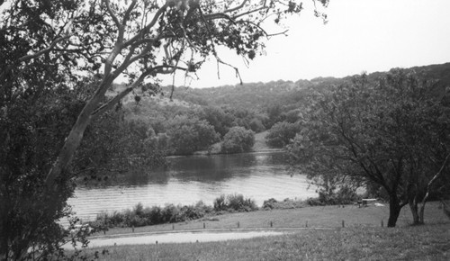
Stradling Lake
Austin
Photo Courtesy of Chandra Moira Beal |
Walsh Boat
Landing
This is a great
place to stop and rest on Lake Austin Boulevard just north of Oyster
Landing — a very popular little strip of trendy restaurants and
shops. The boat launch has a dock where you can swim up to fifty feet
out from the shore. An open water swim is held here each September.
There are a couple of picnic tables and bathrooms for public use.
The LCRA headquarters is located across the street and has information
about Lake Austin and other facilities. |
Fritz Hughes
Park
This park is off
of RR 620 on Low Water Crossing Road (turn left on Fritz Hughes Road).
It's a five-acre day use park with rest rooms, picnic tables and grills,
a playscape and sports courts. The park is faced by residential housing
on one side and the lake on the other. The access road winds around
to the lake front. It's not a great swimming spot because the water
can be swift, but it is allowed. |
Mary Quinlan
Park
This park at the
very end of Quinlan Park Road, has the only boat ramp within several
miles. It is 5.8 acres and for day use only. The park has rest rooms,
a few picnic tables and grills, sports courts, and easy access to
the lake. |
Selma Hughes
Park
Photo Courtesy of Chandra Moira Beal |
Selma Hughes
Park
This park off of
Quinlan Park Road on Selma Hughes Park Road is a quiet five acres
for day use only, with rest rooms, picnic tables and grills. It is
a small shaded park with a sandy beach. |
Hwy
360 Boat Ramp
Located just under the Percy
Pennybacker Bridge, there is a three-acre grassy area where picnicking
is allowed. The boat ramp and park are for day use only, and rest
rooms are available. This park has gained a reputation for moonlight
skinny-dipping. Swim at your own risk.
Access is limited to the narrow, northern portions of Lake Austin.
May 2002
Excerpted from
"Splash across Texas" by Chandra Moira Beal
with permission |
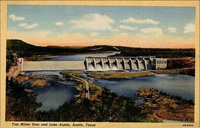
Tom Miller Dam
and Lake Austin
Postcard courtesy www.rootsweb.com/ %7Etxpstcrd/ |
Tom Miller
Dam and Lake Austin
From Dam
Fun - Highland Lakes and Dams by Rob
Hafernik
Tom Miller was the mayor of Austin when
the dam was completed, so they named it after him. Two dams had been
previously constructed on the spot and both had been washed away,
with catastrophic consequences. The first time, in 1900, the dam was
a masonry dam (built of granite blocks) and about half of it washed
away. The second dam was hollow and used wooden gates. It was damaged
in 1915 and several more times in the 1930's until the city finally
built Tom Miller dam, which stands to this day (although with some
upgrades)...
Above the dam is Lake Austin, a constant level lake with many,
many expensive homes and boats. It holds about 21,000 acre-feet of
water and, when it's flowing the way it is right now, pushes enough
water through Tom Miller Dam to generate 17 megawatts of electricity.
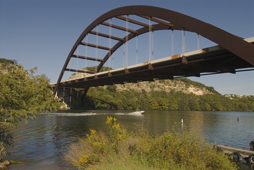
It's also home to the Pennybacker
Bridge, which is a sort of Austin
icon (although everyone just calls it the "Loop 360 Bridge"). |
 |
| Texas
Escapes, in its purpose to preserve historic, endangered and vanishing
Texas, asks that anyone wishing to share their local history, stories,
landmarks and recent or vintage photos, please contact
us. |
|
|