|
"On
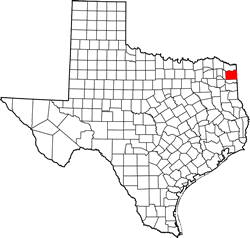
FM 125 in southeastern Cass
County about three miles west of McLeod
and ten miles from Tri-States. Tri-States is known by some as Three
Corners, the place where three state lines meet. The larger region
known as the Ark-La-Tex includes Three Corners and as the name suggests,
portions of Arkansas, Louisiana and Texas.... " - N. Ray Maxie.
From The
Ark-La-Tex and Bogus Springs
History in a Pecan Shell
Not much is known about early Bogus Springs. The name is very likely
a corruption of Baugus, since there was a family by that name in the
area. It is thought that Baugus Springs was the earlier name for the
same community. As the name suggests, the settlement grew around a
fresh water spring.
In the 1930s, Bogus Springs had a single business and ten residents
- growing to 20 people by the 1950s. According to the Handbook of
Texas, Bogus Springs ceased to exist as a named community by 1986.
Mr.
Ray Maxie of Conroe, Texas,
a former Cass Countian who grew up in the area contributes this information:
"The 1942 edition of an ESSO Oil Co. Texas Road map (Standard Oil
of NJ) forerunner of Exxon,) shows Bivins.
I grew up at RR. #1, Bivins, Tx and
was 3 years old when this map came out.... This is the only map I
have ever found that includes Bogus Springs. I would never have thought
it deserved being on a map.
Many times I have drank water from this spring, now long gone and
dried up. It was less than 100 feet off the road and was boxed in
with cypress wood to contain the water. In the 1940's and '50's, each
morning oilfield workers (Including my dad) would stop and fill their
water jugs for the day.
Several years ago, I was saddened when I went there with a shovel
intending to dig the old spring out and revive it. It was to no avail.
The spring was so dried up that narry a bit of moisture could be found.
And the large old oak tree whose roots the spring came from was gone."
- Ray
Maxie, Conroe, Texas |
| Texas
Escapes, in its purpose to preserve historic, endangered and vanishing
Texas, asks that anyone wishing to share their local history, stories,
landmarks and recent or vintage photos, please contact
us. |
|
|