|
History in
a Pecan Shell
Formerly the headquarters
of Rancho Salinas, this community was once a favored crossing point
for Pre-Columbian tribes. It was part of Nuevo Santander province
under Spanish rule and with Mexican Independence, it became part of
Tamaulipas State. After the Mexican War, it became a part of the United
States.
In the 1750s, five area ranches raised thousands of horses and as
many as 40,000 head of sheep.
In the past, residents were mostly ranch workers and migrant laborers.
The 1990 population was reported as 155 which increased to 304 by
the 2000 census. |
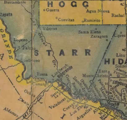
1940s Starr
County map showing Salińeno
(Below "S" in "STARR")
From Texas state map #4335
Courtesy
Texas General Land Office |
| Texas
Escapes, in its purpose to preserve historic, endangered and vanishing
Texas, asks that anyone wishing to share their local history, stories,
landmarks and recent or vintage photos, please contact
us. |
|
|