|
|
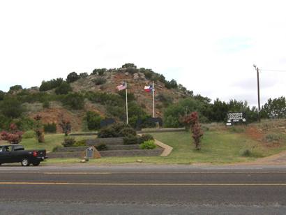 |
Historical
Marker:
Dickens Springs
At one time, water
covered this area. Sandstone, the prominent rock around this site,
is porous, causing exposed strata at canyon rims to form a natural
drainage outlet for upland aquifers, making possible the existence
of these springs. Situated at the head of a canyon ravine immediately
below the Upper Prairie Region of the Rolling Plains, the ancient
springs have been a favored human habitat since the earliest human
occupation in this region. Many nomadic tribes have used the site,
leaving behind a wealth of archeological evidence.
John A. Askins and his family settled near these springs in late 1883,
and it became known to pioneers as Askins Springs. A traveling
real estate developer called Dr. M. S. Crow arrived here in 1891 and
was a driving force in the organization of the town of Dickens
about a half-mile west of the Askins land. In 1891 he gave a speech
proclaiming his intent to give ten acres around "Crow Springs," as
he called them, to the town of Dickens.
The new city park became known as Dickens Springs. Generations
of Dickens citizens and tourists, attracted by the rugged and colorful
scenery and the unique collection of plants, have visited this site
for picnics and social gatherings. In 1978 the departments of Anthropology
and of Park Management at Texas Tech University made an intensive
survey of the land surrounding Dickens Springs. Though many artifacts
were lost to souvenir hunters, the university workers uncovered a
variety of ancient tools, rarely of local origin. In the 21st century,
Dickens Springs continues to provide water and beauty to the area
for modern visitors as it did for the nomadic peoples of the past.
(2000) |
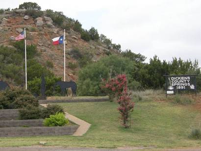 |
Dickens Springs
Historical Marker
Photo courtesy Barclay
Gibson, July 2009 |
|
|