|
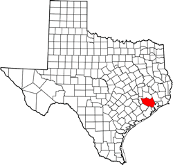
History
in a Pecan Shell
The community dates
from 1915 when Houstonian Charles Bammel and his business partner
built the �Bammel and Kuehnle Merchandise Store.� In 1916 there were
enough residents to request a post office � and one was opened inside
the store with Herman Kuehnle as postmaster.
The store burned in 1927 but was soon rebuilt. The post office, however,
closed in 1929. Prior to 1929 there are no population estimates but
1929�s rough estimate was about 50 people.
In 1938 there was an oil discovery which boosted the population to
200 by 1943. But the proximity to Houston
left only 20 residents by the end of that decade.
The town has since been absorbed by Greater Houston. |
Where Bammel
once was
Photo courtesy Ken
Rudine, May 2010 |
Photographer's
Note:
THE ROAD TO
BAMMEL, TEXAS
The sprawl of an
urban metropolis, as in other states, gobbles up outlying communities
making them invisible. Circling Houston's northwest quadrant, the
towns of Satsuma, North Houston, Kohrville,
Klein, Westfield and others have disappeared during the last 30 years
like persons who stepped in quicksand. As for Bammel, I have been
to a favorite restaurant there many times; although I was unaware
I was in the former town.
Bammel�s GPS location shows it as being in the intersection of FM1960
& Kuykendahl. A bridge over Kuykendahl at this intersection was recently
completed to relieve traffic congestion. I had hoped that a current
view of where Mr. Bammel�s store was located might be a window into
the past.
Looking for remnants, accidentally on purpose, we arrived at our destination
much like a circling buzzard finding road kill. I got out of our car
with my white Stetson on, partially to protect me from the bright
sunlight and partially to be seen.
I began to compose a photo of the intersection. Immediately I could
tell I needed a higher angle of view and it would be more colorful
if I made it at dusk when the lights would be on. I was still looking
to improve the scene when I noticed two white cars pull off Kuykendahl
a few feet in front of me.
The first car had a man and a woman in it, but the second had only
one man who looked like he may have been a drug lord. The occupants
of both cars gave me a good looking-over. I glanced behind me to see
that my wife had moved our car forward to close the gap between us
providing a refuge if needed. Over the last 30 years, FM1960 (formerly
Jack Rabbit Road), has been developed to the nth degree, but now it
is well along into a decline.
Regardless of my perceived threat from the second 2nd car, it moved
on in the strip center out of sight. The car with the man and woman
though made a gentle circle and approached me on the passenger side.
I judged them to be upright citizens. As the car rolled to a stop,
the seventy-five year old lady rolled down her window. The driver
was probably her son, which I judged to be in his mid-fifties.
"Are you here photographing the traffic light� she asked? I told her
no, I was recording the current location scene of where Mr. Bammel�s
store had historically been located. She said "Oh, yes, Bammel's store".
At this point her son chimed in, too. "That�s right, it was right
here. I thought you might be timing the traffic light since the caution
light is really short sometimes." She stated that she had spoken to
a man who hated those traffic cameras and if he was to get a ticket
he wanted it to come from an officer not a machine.
On today�s trip, she found out that this intersection's cameras were
not the ticket issuing kind. I found there are roads to Bammel but
no signs tell you when you arrive.
- Ken
Rudine, May 08, 2010 |
| Texas
Escapes, in its purpose to preserve historic, endangered and vanishing
Texas, asks that anyone wishing to share their local history, stories,
landmarks and recent or vintage photos, please contact
us. |
|
|