|
| In
the first chapter of what was the treasure-hunter's bible for many
years, J. Frank Dobie's CORONADO'S CHILDREN, there is a story called
"The Rangers' Creek of Gold." Dobie told this tale as 'once upon a
time a long time ago in a land far away.' Yet in the story there are,
if you read it critically, enough clues to tell you what time of year
it occurred, where in Texas it occurred, approximately what year it
occurred, and the exact location of the creek of gold. |
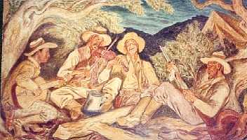
Hamilton Post
Office mural of Texas Rangers
TE photo
|
Basically, the
story is this. 'Once upon a time a long time ago in a land far away'
there were two of McCulloch's rangers, who were on scout west of Hamilton.
They awoke in camp one morning in a typical Hill-Country pea-soup
fog. During the night their horses had managed to slip the picket
line and wander off. Instead of sitting tight and waiting for the
fog to burn off, they went looking for the horses in the fog. When
the fog finally did burn off, sometime around noon, they not only
hadn't found their horses, they'd lost their camp as well. In camp
were their saddles, their rifles, their food and their all-important
water. They were now afoot in unknown, possibly hostile territory
without food or water, armed only with pistols and sheath knives.
They went looking for some sign of civilization, which they knew would
lie to the southeast. It was hot and dry, and they searched for water
as they walked. Every time they spotted a line of green in the distance,
it proved a false alarm-every creek they came across was dry. It was
so hot and they were so dry they took bullets out of their cartridges
and put them in their mouths to generate a flow of saliva.
At last, late in the afternoon, they saw a long, rough mountain in
the distance. Alongside it was a line of green. Although they'd all
but lost hope of finding water, this line of green didn't turn out
to be a false alarm. There was a cold, spring-fed, flowing creek to
accompany it. The men fell on their bellies and began to suck the
life-restoring water out of the creek. Suddenly one stopped, plunged
his hand into the water, and came up with some shiny, yellow-colored
pebbles. The creek contained gold. Belatedly cautious, the men did
not fill their pockets with gold. Instead, each took a representative
sample.
As night was falling, they spotted a wild turkey roost. One of the
men slipped up on it and shot a turkey with his pistol. They built
a fire of dry oak, which gives very little smoke, and roasted the
turkey. After eating their fill and drinking more water, the men slept
in a grove of trees alongside the stream.
The next morning they once again ate as much turkey as they could,
drank as much water as they could, and set out to the southeast, searching
for signs of civilization. As they rounded the north end of the long,
rough mountain, they saw, sticking in a dead tree, the head of a miner's
pick. They weren't the first to find the creek, but the pick had been
in the tree long enough for the handle to rot away.
Late that afternoon they topped a low ridge and saw, in the distance,
Packsaddle Mountain, the first landmark they recognized. From Packsaddle
they got their bearings and soon found civilization. The gold was
pronounced 'drift' or placer gold, probably from a very rich mother
lode farther up the creek. However, the men could never find their
way back to the creek of gold.
In
1980, while doing research for my first book, THE LOST SAN SABA MINES,
I drove a part of Texas Highway 71 I'd never been on before. I knew
71 as 'The Llano Lane,' the road from Austin
to Llano,
but I had never had occasion to drive that part of 71 to the northwest
of Llano. I had been to Paint
Rock to see what may-or may not-be a pictograph on the Concho
Canyon wall that depicts the burning of the San Saba mission. I stayed
the night in Brady
and came south toward Llano on 71. Just at the Llano
County line I saw a long, rough mountain. Alongside it was Cold
Creek, a spring-fed, year-round creek. Fourteen point seven miles
farther on I topped a low ridge-and there was Packsaddle in the distance.
That's when the flashbulb went off in my head.
I turned my car around, drove back to the creek, and carefully clocked
the distance to the ridge. It was exactly 14.7 miles on my odometer.
Better than 14� miles is a 'long day's walk,' especially if you're
in possible hostile country and taking advantage of cover and concealment
as you walk-which the two 'McCulloch's rangers' would have been. Could
this mountain-which, I learned, is known as Smoothingiron Mountain
from its shape, and happens to be the highest point in Llano Country-be
the 'long, rough mountain' the rangers described? Could Cold Creek
be the rangers' creek of gold?
Reality reared its ugly head. I had located a long rough mountain
accompanied by a spring-fed, year-round creek within a day's walk
of coming in sight of Packsaddle. Was it the only long, rough mountain
accompanied by a spring-fed, year-round creek within a day's walk
of coming in sight of Packsaddle? That required research.
As an old artillery forward observer, what is known as 'map recon'-examining
topographical maps to determine the lay of the land-is more or less
in my bones. I ordered, from the US Geological Survey, every 7� minute
quadrangle (topographical map of approximately 1:24,000 scale) from
Packsaddle on the south to Hamilton on the north, and for fifty miles
to the west. These I spread out on my livingroom floor and began my
research. The first thing I did was put a pin in the west peak of
Packsaddle, tie a string fifty scale miles long to it, and swing an
arc from due north to due west. Somewhere within that arc the rangers
had to be when they lost their camp. Where were they?
Well, they weren't as far north as the San Saba River, because the
San Saba is a permanent stream. Had they been that far north they
would have had water, and would simply have followed the river to
its junction with the Colorado. They weren't as far south as the Llano
for the same reason. Therefore, they had to be between the Llano and
the San Saba, which narrowed my search area considerably.
My next task was to examine the elevations to determine from which
direction Packsaddle can be seen 'in the distance.' Packsaddle, while
tall, sits in a low area. The ground slopes up rapidly from the north
and west, but less rapidly from the northwest. It would be possible
to see Packsaddle 'in the distance' only if one were to the northwest
of it on an azimuth of about 300�. The back azimuth of that is 120�,
so the sight of Packsaddle would be to the southeast-which was the
rangers' direction of travel. So far, so good.
Now-is Smoothingiron Mountain the only mountain in a reasonable distance
of Packsaddle that has a permanent creek alongside it? No hydrographic
datum on my maps was any later than 1918, which meant that any creek
labeled as 'intermittent' in 1918 was also 'intermittent' in the 19th
Century. This would have been before any massive pumping from the
underground water supply which feeds springs. There were several 'long,
rough mountains' accompanied by creeks in the search area, but-with
a single exception-each one was indicated by the broken blue line
which means 'seasonal' or 'intermittent.' Only Cold Creek, Field Creek,
and San Fernando Creek were indicated by solid blue lines. Cold Creek
and Field Creek unite just west of Smoothingiron Mountain to form
San Fernando Creek, which is tributary to the Llano River. Smoothingiron
Mountain had to be the 'long, rough mountain' of the creek of gold
story-and therefore Cold Creek had to be the creek of gold itself.
'Where'
having been determined, I set to work to determine 'when.' First,
the part of the year. Rangers were 'on scout' during the raiding season.
The raiding season extended from the time ponies had forage until
the time they didn't. That was usually mid to late March until late
October/early November. Equinoctial storms in March and April and
again in mid to late September, unless the year is notably dry, will
usually have at least standing water in seasonal creeks until mid-June
and after the fall storms begin. All the seasonal creeks were dry.
That points to July, August, or early September.
Now-what year? I can't be exact, but the signs point to 1839-1840.
First, they're described as 'McCulloch's rangers.' Ben McCulloch was
killed at the battle of Pea Ridge in Arkansas in 1862. This has to
be, then, before 'the War.' Second, 'they took bullets out of their
cartridges and put them in their mouths to generate moisture.' Unless
you've got a very strong bite, you're not going to pull a bullet out
of a brass or copper cartridge case with your teeth. However, removing
a bullet from a paper cartridge for a muzzle-loading rifle or pistol
is easy. All you have to do is tear the paper. Third, they went to
the southeast looking for civilization. After about 1841 there were
settlements west of the Colorado, but they weren't looking for them.
They were moving southeast, toward the Colorado. About the northernmost
settlement west of the Colorado in 1839-1840 was Fort Croghan, where
Llano
now stands. Fort Croghan, a private fortification, not a military
one, was within sight of Packsaddle Mountain on a clear day.
This very real, historical event occurred in the summer of 1839 or
1840, sometime between late June or early July and mid September,
in what are now McCulloch
and Llano Counties.
The 'long, rough mountain with flowing creek' is Smoothingiron Mountain
with Cold Creek. All we lack are the names of the two rangers.
� C. F.
Eckhardt
"Charley Eckhardt's Texas"
June 21, 2006 column |
Texas Books
by C. F. Eckhardt
|
|
|