|
MISSION, TEXAS
Hidalgo
County, South Texas
26�12'41"N 98�19'17"W (26.211402, -98.321277)
US 83 and Hwy 107
3.5 miles N of the Rio Grande
18 miles SE of Edinburg
the county seat
8 miles W of (and adjoining) McAllen
Population: 83,563 Est. (2016)
77,058 (2010) 45,408 (2000) 31,100 (1990)
|
 |
History in
a Pecan Shell
The settlement
of Mission is directly tied to once was the La
Lomita community, some 5 miles south. The French Oblates of Mary
Immaculate developed a chapel on this portion of land which had dated
back to a Spanish land grant. Up until 1904, the railroad had only
advanced 5 miles from La Lomita to a railhead
town known as "Mamie." The railroad was enticed (by a new depot
and 20 acres of land) to extend the remaining distance to what became
Mission.
In 1907 when the railroad arrived Mission developed from an influx
of new arrivals and the moving of the operations of the Oblate fathers.
John J. Conway and J. W. Holt purchased the La Lomita Ranch from the
religious order and with other accquired properties, they parceled
the land into small tracts for resale.
The naming of the post office in 1908 accounts for the name change.
Since another Lomita, Texas had been granted a post office under that
name, the name Mission was submitted to and accepted by postal authorities.
1908 was a busy year for the town with a school and pharmacy joining
the depot and post office. The next year a hotel was built and a newspaper
was established. Mission incorporated in 1910.
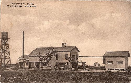
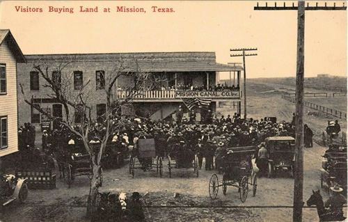
A developer named John H. Shary improved the extant (but crude) irrigation
system and sold small tracts of land for farms around 1910. The long
growing seaon allowed vegetable farmers to grow three crops a year.
Shary's name lives on with the community named Sharyland (adjoining
McAllen).
Oil was discovered in the 1930s, providing a boost to the economy,
but it was nothing like the oil discoveries further north near Freer.
In 1941 Shary and other businessmen bought land northwest of Mission
which they then sold at cost to the government for use as an air field.
Named Moore Field, it maintained a population of about 3,000 during
the years of WWII.
Former airmen and their families returned to settle in Mission after
the war. At the close of the WWII
it became Tri-Cities Airport and then during the Korean conflict it
was activated as Moore Air Force Base in 1953. It closed again in
1960.
Populations:
1915: 2,000, 1940: 6,000, 1950: 10,700, 1960: 14,000, 1970: 13,000,
1980: 22,500, 1990: 31,100 and 2000: 45,408 |
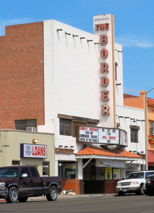
Mission Attractions
& Nearby Destinations
|
 |
La
Lomita - On FM 1016, 3 miles south of US 83.
La Lomita Chapel, circa 1889, and the municipal historical park
Los
Ebanos Ferry on the Rio Grande -
The last hand-operated ferry on either border.
Bentsen-Rio
Grande Valley State Park
World Birding
Center Headquarters - 956-584-9156
Located in the Bentsen-Rio
Grande Valley State Park.
Anzalduas
County Park - 4 miles S of Mission on the Rio Grande.
Ideal place for butterfly and bird watching. 956-585-5311
Santa Ana
National Wildlife Refuge - 956-784-7500
23 miles SE of Mission
Abundant wildlife, plants, and birds (many not found anywhere else
in the United States.) Entrance quarter mile east of the intersection
of US 281 and FM 907. 4 miles East of the Pharr/Reynosa International
Bridge.
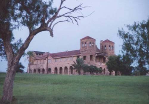
Shary-Shivers
Estate - 4 miles north on FM 494
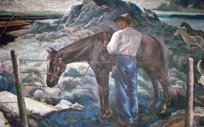
Tom Landry
Mural - In downtown Mission. Corner of North Conway and 101
E. Tom Landry Ave.
Mission
Hotels > Book Here
Mission's
Major Events
Contact the chamber
for details - 800-580-2700
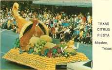
Texas Citrus
Fiesta - Annual celebration in January
Texas Butterfly
Festival - October
|
 |
St. Joseph &
St. Peter Seminary in Mission.
This Seminary burned in 2009.
Photo courtesy Barclay
Gibson, July 2004 |
|
|
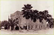
First Christian Church
1940 Postcard courtesy rootsweb.com/
~txgenweb// postcards/Index.html |
|
|
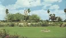
Shary
Memorial Chapel, Mission, Texas
Postcard courtesy rootsweb.com/
~txgenweb// postcards/Index.html |
|
|
Texas
Citrus Fiesta
Postcard courtesy rootsweb.com/
~txgenweb// postcards/Index.html |
Native Son
Kid
Mendoza' and the Battle of the Bulge
Sgt. Jose Mendoza Lopez
Born in Mission, Texas, on July 10, 1910.
December 1944 found Lopez in a bloody conflict known as the Battle
of the Bulge. For his actions on Dec. 17, 1944, near Krinkelt, Belgium,
Lopez received the highest military decoration for valor in combat
� the Medal of Honor.
Mission, Texas, named a street and city park after him.
|
| Texas
Escapes, in its purpose to preserve historic, endangered and vanishing
Texas, asks that anyone wishing to share their local history, stories,
landmarks and recent or vintage photos, please contact
us. |
|
|

 Texas
Gulf Coast
Texas
Gulf Coast East
Texas
East
Texas Central
Texas North
Central
Texas North Central
Texas South
Central
Texas South Texas
Panhandle
Texas
Panhandle South
Texas
South
Texas Texas
Hill Country
Texas
Hill Country West
Texas
West
Texas Texas
Ghost Towns
Texas
Ghost Towns Texas
Counties
Texas
Counties