|
Ghost Town
Thurber
1886-1934
|
 |
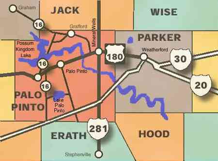
Leaving
Palo Pinto on Hwy 4
South you'll see why this is called the North Texas Hill Country.
You can turn on FM3137 to see Lake Palo Pinto and then take 919 to
Gordon. Continue south on 919 and get on I-20 West. Or
a simpler route is Hwy 4 to I-20 and then west where you will see
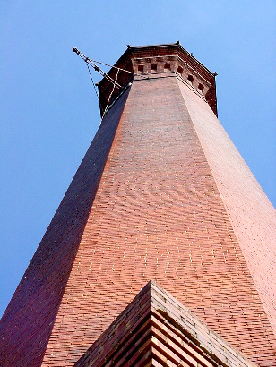
on the right a large brick smokestack
that serves as a tombstone for the ghost town of Thurber.
(Reader's comment: FM 4 from I-20 (just west of New Salem)
to the village of Palo Pinto was the first scenic roadway designated
as such by the State. -- Arnold Ziffel )
There is no tumbleweed here, no saloon sign swinging from a rusty
squeaky chain. But the story of this town is more interesting
than any abandoned western town, even more so because it was once
a thriving city. One of the first cities in the world to be electrified,
Thurber was also surrounded by a barbed wire fence patrolled by mounted
guards to prevent citizens from spending their money elsewhere and
to keep labor organizers out. |
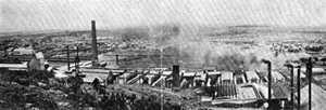 |
The Thurber
Brick yards.
Old post card TE Archives |
The smokestack
in Thurber
TE photo, 2001 |
THURBER,
TEXAS
Texas' premier ghost town
Only Indianola's
story comes close to equaling the Thurber saga. Once the largest city
between Fort Worth
and El Paso,
Thurber became a ghost due to corporate decisions and not the forces
of nature, as was the case with Indianola... Thurber
›
� John
Troesser
April 1998 |
|
|