|
 |
History in
a Pecan Shell
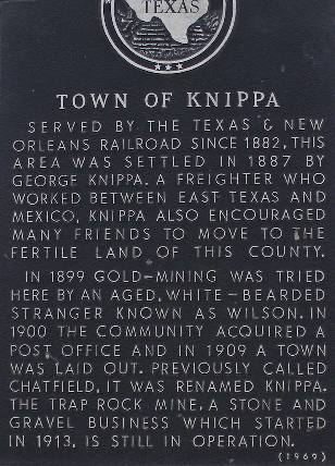
Shortly
after the Galveston, Harrisburg and San Antonio Railroad laid tracks
into the area, one George Knippa moved his family to the railroad
siding that was called Chatfield. Our source The Handbook
of Texas gives no explanation of this name � perhaps it was a
description of how the people entertained themselves in an agricultural
area. George had been to Uvalde County and was impressed with how
verdant and bountiful the land was.
He convinced his family to leave their home in Fayette County and
move west.
Of course fate couldn�t resist making a liar out of Mr. Knippa and
a drought soon appeared that sent most of the settlers back to where
they came from.
A post office was opened in Knippa in 1898. Small amounts of gold
were found in the area and a gold mine was opened west of town � but
it soon proved too costly to remove the miniscule amounts of gold.
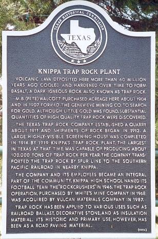
Instead the railroad used the abundant traprock for its roadbed.
(See Knippa Trap Rock Plant Historical
Marker)
The material is still mined today and the main gates of the quarry
open onto Highway 90. This is part of the operation that mines asphalt
south and west of Uvalde.
In 1900 Knippa had a one-room school, which was expanded to a two-room
building by 1907. The population was a mere 50 people in 1914. A directive
prohibiting the speaking of German was instituted when the US entered
WWI. This seemed unfair,
unnecessary and uncalled-for to the German-speaking townsfolk and
they took the matter all the way to the U.S. Supreme Court. The court
agreed.
A Reverend Rubottom ministered to the Baptist flock in Knippa in 1915. |
Knippa, Texas
Landmarks & Historical Markers
|
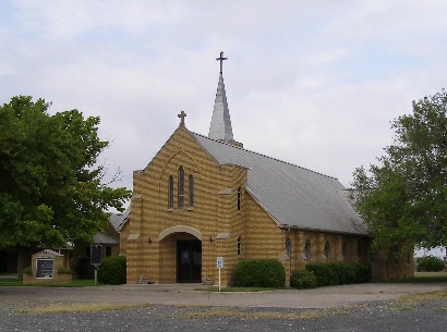
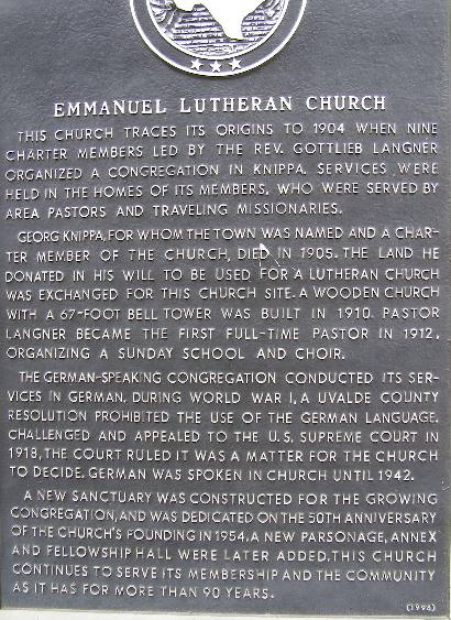
Emmanuel
Lutheran Church historical marker
Photo courtesy William
Beauchamp, June 2012 |
Knippa Trap Rock Plant Historical Marker
TE Photo, June 2001 |
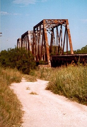
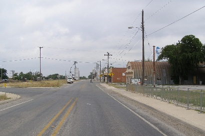
The
Bridge Just West of Knippa
TE Photo, June 2001
More Texa Bridges |
|
|
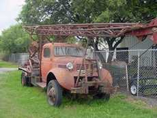
A water drilling rig in Knippa
TE Photo, 4-04 |
| Texas
Escapes, in its purpose to preserve historic, endangered and vanishing
Texas, asks that anyone wishing to share their local history, stories,
landmarks and recent or vintage photos, please contact
us. |
|
|

 Texas
Gulf Coast
Texas
Gulf Coast East
Texas
East
Texas Central
Texas North
Central
Texas North Central
Texas South
Central
Texas South Texas
Panhandle
Texas
Panhandle South
Texas
South
Texas Texas
Hill Country
Texas
Hill Country West
Texas
West
Texas Texas
Ghost Towns
Texas
Ghost Towns Texas
Counties
Texas
Counties