|
Harvey
wasn't the first hurricane to stall over Texas as a tropical storm
and dump several feet of rain in a short amount of time. In September
of 1921 a hurricane much weaker than Harvey made landfall at Tampico,
Mexico, roared through South Texas and stalled in Central Texas. The
Williamson County
town of Thrall
received more than a year's worth of rainfall - 38.21 inches - in
24 hours, a U.S. record that stood for more than 70 years.
More than 200 people in Texas drowned in that 1921
flood, including 92 in Williamson
County. Thousands of head of livestock were washed away, along
with houses, churches, stores, barns and bridges. The bridges that
weren't washed away created impromptu debris dams that accelerated
the flooding past what anyone had imagined possible.
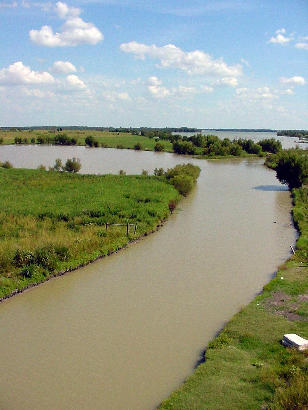
Nor was that the first time such a thing had happened. It happened
on the San
Gabriel River in 1869, 1900 and 1913. But the property damage
left behind by the 1921
storm was astounding. The San
Gabriel has two main forks, north and south, and people in Williamson
County quickly saw damming both of those forks as the only remedy
for the San
Gabriel's habit of going on a rampage every few decades. |
| "It
was an expression of collective will, cutting across all segments
of the population," Linda Scarbrough wrote in her 2005 book "Road,
River and Ol' Boy Politics." But no one in eastern Williamson
County around Granger
imagined the government or anybody else would build a dam in the heart
of the Blacklands, the fabled Black Waxy, one of the most productive
agricultural regions of the state. |
|
The
U.S. Army Corps of Engineers, however, was concerned only with flood
control and held little sentiment toward the Black Waxy or agriculture
in general. The agency decided that a dam at Laneport, about four
miles from the Milam
County line, was the best solution.
"It was as if a government agency devoted to protecting the nation's
oil deposits decided to destroy its most productive oil fields, on
the theory that other oil fields might be developed through that destruction,"
Scarbrough wrote.
The first indication of the Army's plans came in 1948, when the Corps
of Engineers held a meeting in Taylor
to announce the proposed locations of the long-anticipated dams. At
first, many people at the meeting thought the government's plan to
put a 20,000 acre lake smack dab in the middle of the county's richest
farm land was too weird to be true. For the better part of three decades
these people had put their collective will into building two dams
on the forks of the San
Gabriel to save them from future floods, but now the government
had decided to flood their piece of the county permanently. Disbelief
turned to outrage, which turned into a political stalemate.
The cussing and discussing continued for the better part of the next
decade, escalating into sort of a Williamson
County civil war that pitted neighbor against neighbor and brother
against brother. Then the whole idea made its way to the back burner
where it simmered unattended until the San
Gabriel flooded again in 1957 and reignited the discussions.
By this time, Waco
Congressman W.R. "Bob" Poage and others supported a "small dams" concept
that would dam the streams and branches rather than the river. Poage
had noted in a 1952 press release that nearly every gallon of floodwater
in the rivers' main stems came from "a fairly tiny branch that any
fairly active coon dog could jump across." Keeping the water where
it falls, he said, is flood prevention. In 1958, voters approved by
a 4-1 margin a $140,000 bond to pay the local share of a $5 million
federal "little dams" project.
Just when it looked like the farmers in Williamson
County had what they wanted, the Corps took a renewed interest
in the dams and in 1960 announced three sites—one on each fork
of the San
Gabriel and the one at Laneport, only this time the Laneport dam
would be about 15 percent bigger than the one they'd originally proposed.
U.S. Congressman J.J. Jake Pickle inherited the issue when he took
office in 1964. Interstate Highway 35 would soon cut through Williamson
County, and Pickle knew the county would need more water than
what it could provide without the dams. Scarbrough said that Pickle
basically willed the dams into existence. In 1970, the U.S. House
approved $4 million for construction of two dams on the San
Gabriel River. |
 |
|
Williamson
County has thrived and prospered ever
since, but Granger
has mostly missed out on the opportunities that IH-35 and the dams
helped create. Instead, more than 150 families lost their land to
what would become Granger Lake, many of them taking what
they considered a pittance for land that had been in their families
for generations.
Loretta Mikulencak, quoted in Scarbrough's book, expressed the eventual
outcome of the 1921 flood for the people who lost their land, first
to the river and then to government.
"The chief damage to Granger
was getting those (Czech) families out of there," she said. "They
were stable farm families who had inherited their land and they
weren't going to leave. They never recovered� They just died, one
by one. And the worst of it was it made us bitter - it made us what
we weren't. It made us different people."
Here's hoping Harvey doesn't leave the same legacy.
� Clay Coppedge
"Letters from Central Texas"
September 20, 2017 column
|
|
|


