|
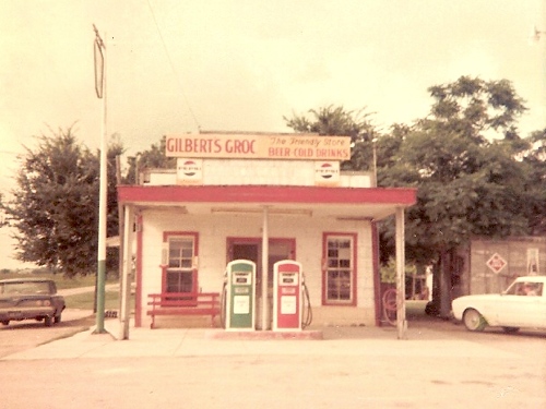
Gilberts Grocery
/ Conoco Gas Station
Photo courtesy Richard Steffek |
History
in a Pecan Shell
Friendship and a nearby town called Old Friendship (AKA Allison)
were founded in the 1880s. According to information provided by Harold
Grinstead, the land was first settled by Elihu Creswell Allison in
1847. Allison was partially destroyed in a 1921
flood.
In the 1970s it was decided to impound the waters of the San
Gabriel River. Laneport Dam (the original name) was the
result. It was renamed Granger Dam some time later. Graves
in the Friendship Cemetery were reinterred at other cemeteries and
the Friendship school consolidated with Granger
schools in 1958. The former Friendship Community holds a reunion every
year on the third Saturday of October.
Friendship Floods >
Friendship - Town Layout &
Old Photos > |
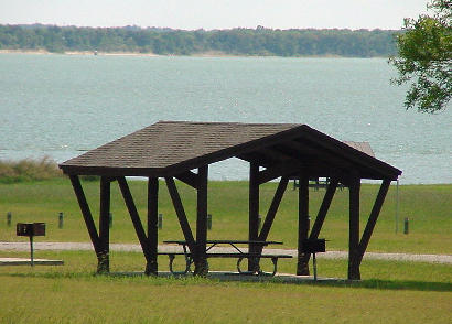
Granger Lake
from the park - more or less where Friendship once was.
TE Photo, 9-04 |
Contributor
Bob Mohel, a former resident of Friendship, has sent in newspaper
clippings with information on the various floods that plagued this
part of Williamson county. The clippings were used to assemble the
information below.
The San
Gabriel River flooded in 1913, causing widespread damage and even
wrecking a train on the M.K.& T. railroad bridge at Berry's Creek.
The biggest flood came in 1921 and a third destructive flooding occurred
on February 22, 1958. The dam was constructed in the late 1970s.
The Deadly
Flood of 1921
The rain started
at 6 p.m. on September 10, 1921 and continued until 6 a.m. on September
11th. Although no official measure was mentioned - it was estimated
that 50 inches of rain fell. One Henry Rozacky (who was 83 when he
gave his report to the paper) had no trouble recalling the soggy events.
He reported that a "dry and empty" 50 gallon drum in his backyard
was overflowing about 2 a.m. and that the lightning was giving everything
a greenish tinge. He reported that the blacksmith shop was washed
away and that the general store was a total loss. He and a neighbor
rescued 26 bales of ginned cotton that were bobbing away from the
gin. In Mr. Rozacky's words: "You'd be surprised how readily 500 and
600 lb bales of cotton can float." He continued: "we got hold of them
and pushed them before us until we reached a hill at the old Brookshire
place. "...and you know, no one gave us a dime for their bales as
they came to take their own." "One man tied a bale onto a tree and
after the waters receded that bale was suspended in mid-air."
The flooding wasn't just in Friendship, either. Further west, the
waters took out the North San Gabriel River bridge in Georgetown.
A family of three in Friendship lashed themselves to a tree but all
drowned. Twenty-six people were trapped at Laneport - when they were
"engulfed" by the flood. All were later found drowned - and Mr. Rozacky
said he helped construct the twenty-six coffins. Rozacky went on to
say that "not a single bridge of any type was left standing." "The
bridge across the San Gabriel at Hoxie was swept away and the railroad
tracks at Circleville stood on end in an arc." One house (the C.B.
Arnold home) was carried downstream and deposited "where it now stands."
Several other homes were involuntarily moved great distances by the
surge of water.
After the rains, mud was everywhere -- its quantity nearly matched
by its depth. With the bridges gone, horses became the best method
of transportation. One man on horseback sank up to his saddle and
had to be pulled out by a block and tackle. Scores of domestic pigs
turned feral and had to be shot.
The old
iron bridge at Hoxie was moved to Wilson H. Fox Park on
Lake Granger and became part of the nature trail.
Finally it was decided that it just wasn't worth it - if the water
wanted Friendship so bad - let the water have Friendship. In the summer
of 1977 the spillway for the dam was constructed.
� John Troesser
See also
Harvey's Ancestor
by Clay Coppedge
The Deadly Flood of 1921 |
Friendship
-
The Town Layout & Vintage Photos
|
Friendship
- The Town Layout
Based on a drawing provided by Bob Mohel, the town of Friendship straddled
Farm to Market Road 971 - the town's only paved street. The north
side of 971 had the school, seed house, gin and scale. The southside
had several residences along with the blacksmith, the Baptist church,
gas station, the Mohel "Beer Joint" and Bob's Barbecue Shack. |
Friendship
Vintage Photos:
I lived in the Friendship community until the dam was built and it
was swallowed by Granger lake. I knew Mr. Richard Caden who contributed
many of the pictures on the web site. [Here are two more photos.]
One is of the Friendship Baptist
Church and the other one is of the Friendship
store, Gilbert's Grocery, the friendly store while it was still
in operation. The Conoco gas pumps are there. Thank you. - Richard
Steffek, May 18, 2011 |
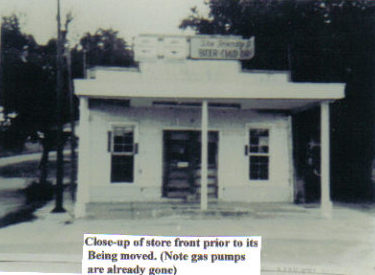
"Close up
of store front prior to its being moved
(Note gas pumps are already gone.)"
Photo
courtesy Richard Cadan
More Texas Gas
Stations |
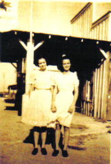
The Lucky Sisters
(Dorothy and Gladys) in front of the original Friendship gas station
Photo courtesy the Lucky Family |
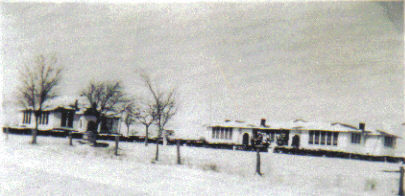
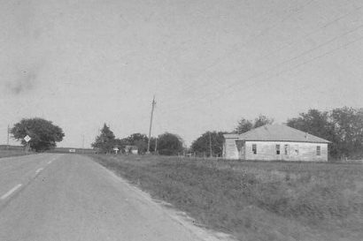
The
Friendship School blanketed in snow.
Courtesy Tony and Martha Machalek. |
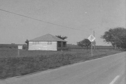
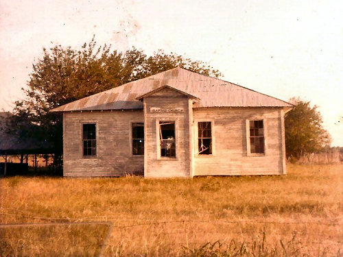
"The last
standing building of the Friendship School. Was used as a community
center and was our polling place."
Photo
courtesy Richard Steffek
More
Texas Schoolhouses |
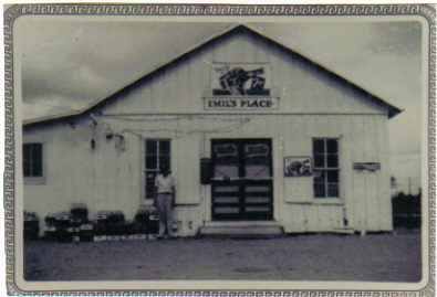
Emil's
Place with Mr. Emil Mohel left of door.
Photo courtesy Hattie Mohel Gaida |
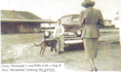
Bill Michalek
with dog. Mrs. Michalek taking photo.
Photo courtesy Tony and Martha Machalek |
"Driving
East into Friendship.
The Friendship Baptist Church is on the right."
June 1971 photo courtesy Richard Steffek |
Friendship Baptist
Church
Photo
courtesy Richard Steffek
More Texas Churches |
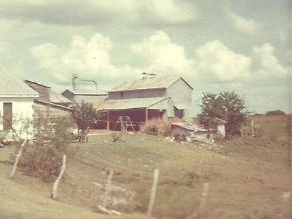
"East side
of the Friendship gin and cotton seed house. The white house on the
left was the home of the gin's operator, Mr. Henry Rozacky Sr. "
July 1968 photo courtesy Richard Steffek |
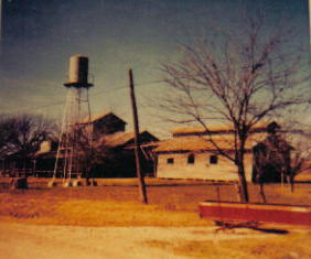
The Friendship
Gin
(Tower used to take following 2 photos)
Photo
courtesy Richard Cadan
More on Cotton / Cotton Gins |
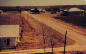
Friendship Ginners
House Lower left.
Photo taken from water tower.
Photo courtesy Richard Cadan |
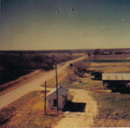
Entering the
Gin yard at Friendship,
and the road west to Granger.
Photo courtesy Richard Cadan |
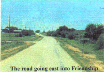
"The Road
Going East into Friendship"
Photo courtesy Richard Cadan |
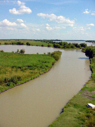
Inlet
to Granger Lake
View from the FM971 Bridge
TE Photo , 9-04 |
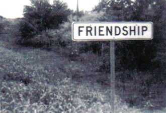
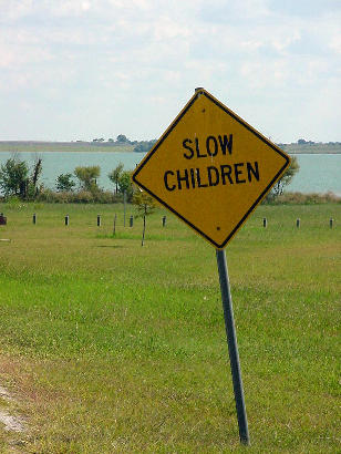
A sign in the
park today.
TE Photo, 9-04 |
| Texas
Escapes, in its purpose to preserve historic, endangered and vanishing
Texas, asks that anyone wishing to share their local history, stories,
landmarks and vintage or recent photos, please contact
us. |
|
|