|
History in
a Pecan Shell
Tampico was on
the Fort Worth and Denver Railroad and was named after the coastal
Mexican capital city of Tamaulipas state, Mexico.
Drillers in 1929 were hoping the appropriated name would bring in
an equally rich oil field.
After drilling ceased, the population dwindled to only 25 persons,
and one lone business. By the mid-1960s there were still 12 diehard
residents, but no statistics are available after that.
A Visit to
Tampico, Texas
|
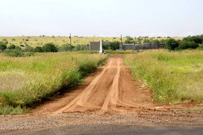
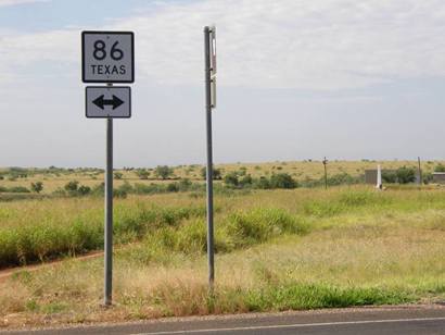
Distant view
of Tampico from Hwy. 86
Photo courtesy Barclay
Gibson, July 2009 |
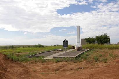 |
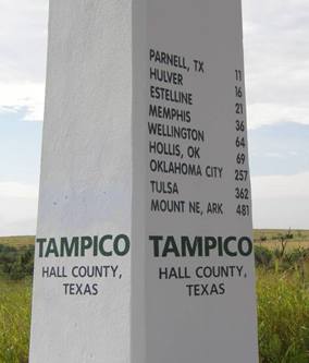
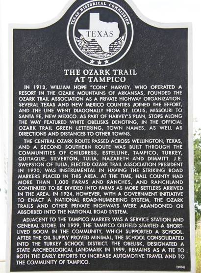
Historical Marker
The Ozark Trail
at Tampico
In 1913, William
Hope "Coin" Harvey, who operated a resort in the Ozark Mountains of
Arkansas, founded the Ozark Trail Association as a private highway
organization. Several Texas and New Mexico counties joined the effort,
and the line went diagonally from St. Louis, Missouri to Santa Fe,
New Mexico. As part of Harvey's plan, stops along the way featured
white obelisks denoting, in the official Ozark Trail green lettering,
town names, as well as directions and distances to other towns.
The central Ozark route passed across Wellington,
Texas, and a second southern route was built through the communities
of Childress,
Estelline,
Tampico, Turkey,
Quitaque,
Silverton,
Tulia,
Nazareth and
Dimmitt. J.E. Swepston
of Tulia,
elected Ozark Trail Association president in 1920, was instrumental
in having the striking road markers placed in this area. At the time,
Hall County had more than 1,000 farms and ranches, and ranchland continued
to be divided into farms as more settlers arrived in the area. In
1924, however, with a government initiative to enact a national road-numbering
system, the Ozark Trails and other private highways were abandoned
or absorbed into the national road system.
Adjacent to the Tampico marker was a service station and general store.
In 1929, the Tampico oilfield started a short-lived boom in the community,
which supported a school. After the oil supply proved minimal, the
school consolidated into the Turkey
school district. The obelisk, designated a State Archeological Landmark
in 1999, remains as a tie to both the early efforts to increase automotive
travel and to the community of Tampico. |
 |
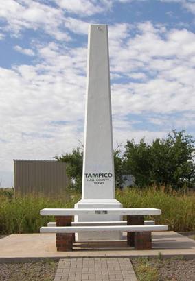
The Ozark Trail
monument
Designated State Archeological Landmark
Photo courtesy Barclay
Gibson, July 2009 |
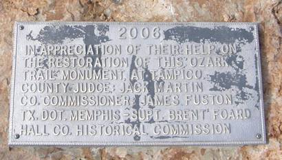
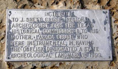
Ozark Trail monument
plaque at Tampico
Photo courtesy Barclay
Gibson, July 2009 |
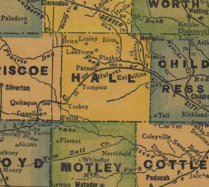
1940s Hall
County map showing Tampico
Courtesy Texas General Land Office |
|
|

 Texas
Gulf Coast
Texas
Gulf Coast East
Texas
East
Texas Central
Texas North
Central
Texas North Central
Texas South
Central
Texas South Texas
Panhandle
Texas
Panhandle South
Texas
South
Texas Texas
Hill Country
Texas
Hill Country West
Texas
West
Texas Texas
Ghost Towns
Texas
Ghost Towns Texas
Counties
Texas
Counties