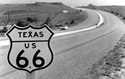
|
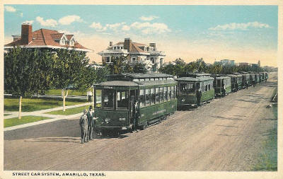
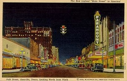
Amarillo Texas
Polk Street Trolleys
Photo courtesy texasoldphotos.com |
History in
a Pecan Shell
The railroad (Fort Worth and Denver City) was
coming through the Panhandle in 1887 and merchants from Colorado City
wanted to establish stores at a logical stop. Since they needed voters
to choose the county seat and most of the voters were ranch hands
of the LX Ranch, the promoters promised them each a residential
and business lot to vote for Oneida. Not surprisingly Oneida
won and was promptly renamed Amarillo.
The first houses in town were actually painted yellow in honor of
the new name and perhaps in guilt for mispronouncing the Spanish word.
A rancher named Sanborn bought land on the other side of the
tracks because of its elevation and convinced others to move their
businesses there as well. Actually, rains and the subsequent flooding
did most of the convincing. This was the beginning of Polk Street,
the city's main commercial boulevard.
The city grew steadily, adding an Opera House in 1909 and a library
in 1910. Helium discoveries in the late 1920s and the establishment
of an Army AirField, led commercial growth until the depression arrived.
Because the city was the focal point of government programs during
the depression, the city's infrastructure benefited greatly from the
Work Projects Administration. (See Thompson
Park)
Amarillo grew 85% in the decade of 1950-1960, from 74,000 to 138,000.
The population in 1980 was 149,000 and in 1990 it was 158,000. The
2000 Official Highway Map shows the population to be 168,562.
Amarillo Hotels
> Book Here |
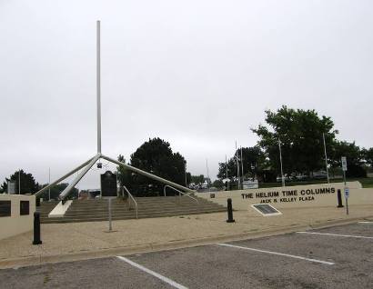
Historical Marker
Location: 600 South Buchanan Street, Civic Center courtyard
AMARILLO
Named for Arroyo
Amarillo, nearby creek given its designation by Spaniards in early
days. In 1887, when the Fort Worth and Denver City Railroad was building
through this region, a group represented by J. T. Berry platted the
town (1 Mi. W.). The founders were merchants of Colorado
City (250 Mi. SE), establishing convenient trade facilities for
their South Plains customers.
Later (Aug. 30) that year, Potter
County was organized and Amarillo was chosen county seat by 38
LX and 15 Frying Pan cowboys as electors. In 1889 heavy rains and
other inducements were factors influencing residents to move to this
new townsite addition promoted by J. F. Glidden and H. B. Sanborn,
owners of the Frying Pan Ranch (headquarters 16 Mi. W). In 1892 Glidden
traded his interest in the city for Sanborn's interest in the ranch.
In the years 1892-1897, Amarillo was the largest rural shipping point
for cattle in the
nation. When a rail line to serve the South
Plains was proposed, Amarillo and Washburn
(15 Mi. SE) were rivals for the junction. Amarillo won, through efforts
of city developer Sanborn. When construction began in 1898, Amarillo's
future was assured: it was to be the commercial center of the Texas
Panhandle.
(1970) |
Amarillo, Texas
Landmarks / Attractions / Images
|
| Submitted
by Rhondelle A. Blankenship, Llano Cemetery |
 |
 |
 |
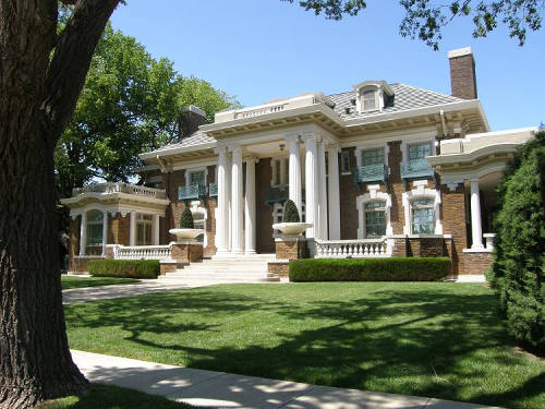 |
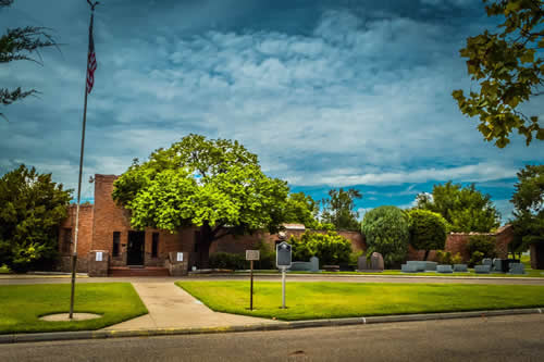
Harrington
House :
One of Amarillo's early and elegant homes (1914) at 1600 Polk Street.
Free tours on Tuesday and Thursday mornings, April to December.
Advance arrangements required. 806-374-5490.
The American
Quarter Horse Hall of Fame & Museum :
A hidden gem of Western art in the Texas
Panhandle. The moment you approach, you are greeted by the beautiful,
larger-than-life bronze statues of history-making American Quarter
Horses Rugged Lark and Refrigerator. Visitors can spend time reflecting
outside at the newly renovated Wall of Honor Plaza, honoring and
memorializing the horses and people who�ve paved the way for the
American Quarter Horse. The Wall of Honor welcomes visitors to the
Hall of Fame from two unique perspectives. From the east, a light
sculpture displays a herd of running American Quarter Horses; from
the west, granite bricks preserve and pay tribute to the people
and horses meaningful to generous donors. www.quarterhorsemuseum.com
English
Field Air and Space Museum :
A project of the Texas Aviation Historical Society, Inc. For directions
and information telephone 806-335-1812.
Thompson
Park
Amarillo
Hotels › Book Here
|
 |
Amarillo Nearby
Destinations:
|
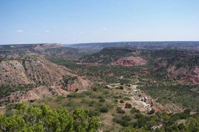
Palo
Duro's Enduring Pageant by Mike Cox
"The show debuted in 1966 and grew into a summer tradition. Thanks
to news media exposure, local marketing efforts and old-fashioned
word of mouth, the pageant�s reputation built with each passing season.
In recent years, USA Today included it in its �Top 10 Must See Theaters
in America� and the American Bus Association�s �Top 100 Attractions
in North America.�
An estimated 4 million people have viewed the pageant over the last
50 years. In recent seasons, the show�s three-month run (six days
a week with Mondays off) has drawn about 65,000 annually.... more
" |
 |
Lake
Meredith National Recreational Area
McClellan
Reservoir
50 miles east of Amarillo on McClellan Creek, Red River tributary
http://www.tpwd.state.tx.us
Amarillo Travel & Tourists Information
Texas Travel
Information Center on I-40 / U.S. 287 just east of Amarillo. Operated
by the Texas Department of Transportation.
Amarillo Convention
& Visitor Council
1000 S. Polk Street, Amarillo, Texas 79101
806-373-7800
Amarillo Hotels
> Book Here
|
People
Eck
Robertson by Clay Coppedge
Of the pioneer types who helped establish a standard for Texas fiddle
playing, Eck Robertson deserves the most credit. Robertson, who
grew up near Amarillo in the late 1800s came from a family of fiddlers...
Tex
Thornton: King of the oilfield firefighters and rainmaker
by Clay Coppedge
The oil fields of the Texas Panhandle in the 1920s and �30s were
a place where a man who knew how to use nitroglycerin could make
a good living for himself. Ward A. �Tex� Thornton was such a man.
He learned all about nitro when he went to work in 1913 for an Ohio
company that manufactured torpedoes. He brought that knowledge along
with a steady hand and no small degree of courage to the oil fields
around Amarillo in 1920...
|
Amarillo
Chronicles
Amarillo
in thick of Dust Bowl by Delbert Trew
"Amarillo - The Story Of A Western Town" by Paul H. Carlson is a
must read for old-timers and those who arrived later. Most who have
lived in the Panhandle very long remember seeing or hearing of our
most notorious history, but few know the little details of how and
why the stories unfolded...
Parade
honoring mothers-in-law drew thousands by Delbert Trew
First intended as a small local event to placate the offended, the
celebration drew national attention when Will Rogers mentioned the
upcoming celebration on his national radio show. Mothers-in-law
from across the nation including first lady Eleanor Roosevelt sent
greetings of varied nature...
Blue
and Gray Reunion by Mike Cox
Arguably, the last battle of the Civil War took place in 1935 in
Amarillo, a city that had not even existed in the 1860s... more
Amarillo
by Airmail by Mike Cox
With five cents in postage and an additional 20 cents for special
delivery, the envelope had left the Panhandle shortly before 8 a.m.
that day. The plane carrying it and airmail landed in Kansas City,
where postal workers transferred the bag holding the letter to Bush
to another plane. That aircraft reached the Windy City at 9:30 p.m.
From the airport, the letter and others went by truck to the north
side post office. When it arrived there, a carrier drove it to Bush�s
residence for delivery only 15 hours and 30 minnutes after it left
Amarillo. While that is snail-like compared with email, it was incredibly
fast for 1930, especially to the Bush brothers... more
Slow
Times at Amarillo High by Mike Cox
When the seniors who would graduate from Amarillo High School in
1942 showed up for their first day of classes, they and all their
underclassmates received an orange student handbook. The booklet
... included some things that would seem totaly bizarre to 12th
graders today, like dating dos and don�ts...
Naked
Came The Amarillan by Maggie Van Ostrand
I love Amarillo ... I never met so many good lookin', boot-wearin',
city-shunnin', plain-talkin', fellas in my entire life as I did
a few weeks back when I visited The Fair And Totally Underrated
City of Amarillo In The County of Potter in the Republic of Texas...
more
Amarillo
by Suppertime by Jase Graves
|
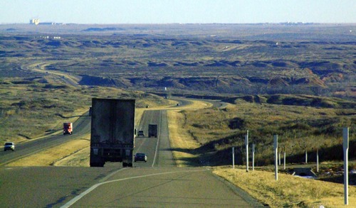 |
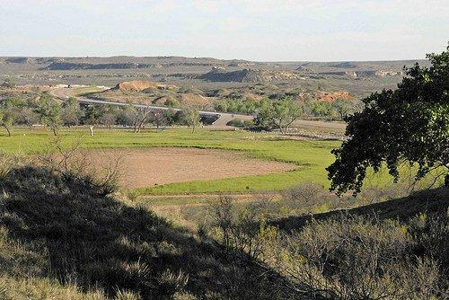
Subject: Canadian
River
Photographer's Note:
These shots are of the Canadian River valley traveling from Dumas,
Texas to Amarillo. You can see Amarillo on the far horizon (to
the South). The river has carved its way through the otherwise flat
plains in a million different channels. The road is U.S. 287/87 which
is the main road from Texas through
the Panhandle to Denver
and other points North.
The Canadian
River today is often just a small stream thanks to the many dams
on the river and its tributaries in New Mexico, but even a short rainstorm
can fill its banks.
The Canadian
River is now an important recreation area for off-roaders, hikers,
and hunters. To the east of these views, the river flows into Lake
Meredith, which is an important source of drinking water and recreation.
- Tom
Jones, December 24, 2007
Amarillo
Hotels > Book Here |
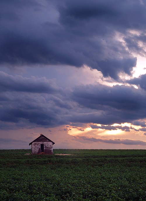
Amarillo Sunset
Photo courtesy John Stankewitz , August 2004 |
| Texas
Escapes, in its purpose to preserve historic, endangered and vanishing
Texas, asks that anyone wishing to share their local history, stories,
landmarks and recent or vintage photos, please contact
us. |
|
|