|
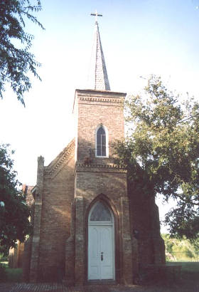
Toluca Ranch
St. Joseph Church and cemetery
Photo courtesy Barclay
Gibson, July 2004 |
History
in a Pecan Shell
In 1776 when the United States was declaring its independence
from England, Juan Jos� Hinojosa was requesting a land grant here
from the Spanish Crown. Fourteen years later (1790) the grant was
approved as part of the Llano Grande grant. Throughout the entire
19th Century, the land around modern-day Progreso was occupied by
small ranches and family farms. The largest spread was Toluca Ranch
in 1880 and a post office was requested under the name Toluca. But
for whatever reason, postal authorities issued the name Progreso.
The office operated under that name from 1901 through 1916. In 1903
developers bought the former ranches and started subdividing the land.
A nucleus developed two miles NW of the post office and they appropriated
the name.
Sugarcane became an important regional crop and in 1920 over
6,000 acres (including the fledgling Progreso and Progreso Lakes)
was sold to become a vast sugarcane plantation. During the progressive
20s, the San Benito and Rio Grande Valley Railroad arrived - installing
a short-lived mission-style depot (closed 1931). After a 1925 freeze
killed the cane crop, it was decided that citrus might be more
resistant to cold weather. The town was platted by the Progreso Development
Company in 1927. The 1929 stock market crash, followed by a hurricane
in 1933 that sent the region into a downward economic spiral. Things
got better but a postwar freeze in 1949 followed closely by a second
freeze in 1951 made growers return to raising cane.
Earlier population figures aren't available but as recent as 1940,
Progresso only had 100 citizens. By the mid-1950s it had more than
doubled to 220. It was estimated at a mere 185 in 1989, but mysteriously
jumped to nearly 2,000 for the 1990 Census. A new bridge across the
Rio Grande helped bolster the population and by 2000, it had swelled
to 3,500, increasing to 4,851 (the figure given on the 2007 state
map). |
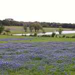
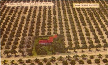 |
Citrus Orchard
Postcard courtesy www.rootsweb.com/ %7Etxpstcrd/ |
Historical Marker
(Progreso City hall, FM 1015, 3 miles N of Hwy
281)
Progreso
Land in this area
was part of a Spanish land grant requested by Juan Jose Hinojosa in
1776 and awarded posthumously in 1790. Hinojosa had occupied the land
and used it for livestock pasture since 1766. In 1896 ranchers in
the area obtained a U.S. post office under the name Progreso. Soon
thereafter commercial farming interests began large scale operations
in growing sugar cane and, later, citrus groves. The Progreso Development
Company platted the townsite in 1927. The town continued a steady
period of growth, and citizens voted for incorporation in 1991.
(1994) |
Toluca Ranch
Photographer's
Note
Toluca Ranch is in Hidalgo County about 1-1/2 miles southeast of Progreso.
The only reference I have ever seen to this church was in the September,
1993, issue of Texas Highways Magazine. It is on private property
and didn't look like it was being used. There looks like a small cemetery
next to the church. - Barclay
Gibson, January 24, 2010 |
Toluca Ranch
St. Joseph Church
Photo courtesy Barclay
Gibson, July 2004 |
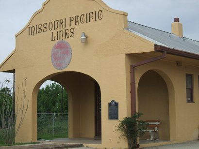
| "The old depot
which was once a stop on the historic Spiderweb Railroad. The depot
was restored about 10 years ago and is now a business of some sort." |
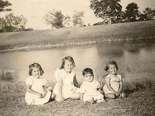
"Reyna kids, left to right are Guadalupe,
Angelica, Severo Jr., and Alicia. "
Progreso
Lakes, Progreso, Texas, circa 1941
Photo courtesy Angelica
Reyna-Bland |
| Texas
Escapes, in its purpose to preserve historic, endangered and vanishing
Texas, asks that anyone wishing to share their local history, stories,
landmarks and recent or vintage photos, please contact
us. |
|
|