|
| Photo
courtesy Regina Crutcher, 2003 |
History in
a Pecan Shell
Named after the
nearby canyon called Mooar's Draw, the community has always
been under populated. Earlier figures aren�t available, but the 1933
count was a mere 25 residents. Somehow, the town gained population
during the Great Depression, reporting 100 for the 1940 census. It
remained at 100 through 1960 but dropped to just 35 in 1970. From
1980 through 2000 it reported 39 residents. |
|
Photographer's
Note:
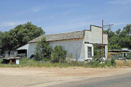
Draw - Out-drawn by economy for sure, but very nice cemetery, as
evidenced by the Vets monument... Gin does not appear to be operational...
And the wheat fields grew all around, all around, and the wheat
fields grew all around... - Rick
Vanderpool, June 10, 2010
|
History
of Draw, Texas
Excerpted from
�Out of Time�:
An Informal History of Draw, Texas
by Nolan Porterfield
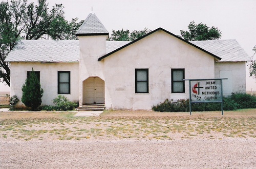
In its heyday sixty
years ago in the late 1940s, Draw, Texas was a bustling, if not exactly
thriving, little village of perhaps 200 people. It boasted two general
stores, a blacksmith shop, one or two cafes (depending on the season
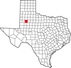
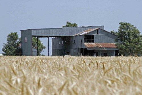
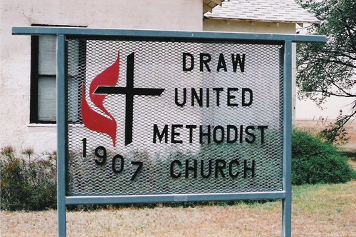
of the year), a cotton gin, a small lumberyard, a Methodist church,
a large six-room redbrick schoolhouse with an auditorium/gymnasium,
and at least a dozen proper residential buildings, along with various
lesser dwellings -- railroad boxcars and a tin shanty or two -- that
housed gin workers and itinerants. Both general stores also doubled
as gas stations and carried a stock of hardware goods, livestock feed,
and small farm implements. To one was attached an ice house, for the
summertime storage (but not manufacture) of block ice, which was transported
from the ice plant in Tahoka. Later
a second gin was built, adjacent to the first and operated by the
same company, and in the fall ginning sometimes went on twenty-four
hours a day for several months, from September until December. In
those years of bumper cotton
crops in the late 1940s, one or another itinerant tent movie operations
appeared at the beginning of the harvest season and set up on some
lot near the gin, showing old cowboy movies and catering to both locals
and the hordes of Mexican-American families who flocked into the community
to pick cotton each fall.
Today, Draw is a ghost town. The gins and all the other businesses
(and many houses) are gone; perhaps a dozen people live there, mostly
in trailers scattered among the ruins.
For many years, I felt sure that the origins of Draw were lost in
the mists of history. It was never incorporated or ever big enough
to support (or need) a newspaper or directory. In light of the general
settlement pattern on the High Plains, I simply assumed that it had
its beginnings around the time of World
War I, and that anyone who might know its history was long dead.
I was wrong on both counts.
One can only wonder what life must have been like there a hundred
years ago, when Lynn
County -- named for an Alamo
defender -- rose from the sovereignty of the generic Texas
soil and was organized into a political and governmental unit in 1903.
(The county was created, but not organized or settled, in 1876, coincidental
with the adoption of the constitution which governs Texas
to this day. Prior to that time, the region which became Lynn
County had been a part of the Bexar District, whose capital was
San Antonio, some
300 miles away.) Growing up there forty years later, during World
War II, when the population was at its peak and the little hamlet
of Draw flourished, I can attest to the fact that life even then was
a rather lonesome and desolate and primitive business -- no paved
roads, electricity or telephones, scarcely any indoor plumbing. On
my grandparents� farm, four and a half miles southeast of Draw, a
single cold-water pipe brought �gyp� water from the windmill into
the kitchen for cooking purposes. Even that was a rare exception.
(�Gyp� water was bitter and full of healthy but vile-tasting minerals;
our drinking water came from a rainwater cistern, drawn up one cedar
bucket at a time and placed on the kitchen counter with a chipped
porcelain dipper. Until well after World
War II, the toilet was �the little house behind the house�; baths
were taken in the kitchen in a Number 2 washtub, with water heated
on the cookstove.)
What then must the first settlers have found when a few scattered
families began to arrive around the turn of the 20th century? I asked
that question of my dear friend Fern Barnes, who has lived there most
of her eighty years. She said �Grass and rocks.� (It surely hadn�t
changed much when her familiy moved there in 1926.) To grass and rocks,
one can add a fairly thick sprinkling of mesquite trees -- although,
to borrow what a Faulkner character once said of willow trees, �a
mesquite ain�t a tree, it�s a weed.� In my time, mesquites were mostly
confined to farmers� pasture lands and the Double U ranch not far
away. With the arrival of the first settlers, arable land was soon
�broken out� and put into cultivation for cotton
and maize. I grew up with the notion -- now apparently erroneous --
that the high plains of Texas were
originally covered in grass so tall that the Spanish explorers, to
find their way in and out, had to mark their routes with high wooden
poles -- the fabled Llano Estacado, or Staked Plain. Now my friend
Andy Wilkinson, who is an authority on all things West Texan, tells
me that it was a mistake. �Estacado,� it seems, was a misspelling
of �Estancado,� which means merely �stockaded,� an allusion to the
high vertical walls of the Caprock
when approached from the lowlands to the east. Besides, as Andy rightly
points out, where would the Spanish have found wood for stakes? Except
for the scrubby native mesquites, the Plains were essentially treeless
until settlers came and planted elms and cottonwoods and such.
The earliest evidence of Draw�s existence comes not from contemporaneous
records but from the memories of those who, fifty years later, contributed
to a history of the Methodist Church there. As early as 1901, there
existed a small building used as a school house and located some one
and a half miles northwest of the present location of Draw. About
1904, this building was moved to a site three and a half miles northeast
of present Draw and became known as �Moore�s Draw School House,� apparently
taking its name from a geographical feature and the otherwise unknown
settler named Moore (possibly spelled �Mooar�) who was identified
with it. How �Moore�s Draw� was shortened and moved to its present
location is unknown; one can only assume that soon afterwards there
were the stirrings of some sort of commercial activity at the crossroads
of what are now the small highways designated FM (Farm-to-Market)
213 and 1054, and those who used �Moore�s Draw School House� as both
school and church decided that was the place to be. Obviously, the
shorter version of the name followed along.
In any event, a small one-room school house was erected there in the
fall and winter of 1906-1907 (the name was now simply �Draw School
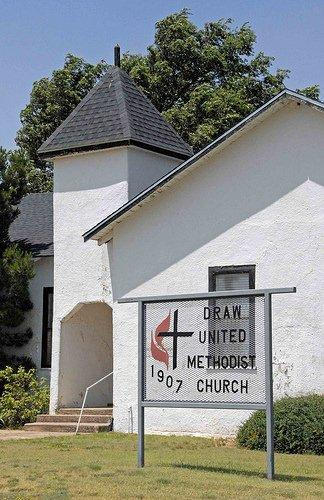
House�). It also served as a meeting place for various religious denominations,
the most prominent and active of which were the Methodists. In March
1907, a Methodist Church was
formally organized, with seven charter members, five of whom were
Mr. and Mrs. W. A. Waller and their three daughters. The others were
Mrs. J. N. (�Kittie�) LeMond and Mrs. R. A. Duckworth. Very soon other
newly-arriving settlers increased their ranks: the families of J.
W. Luttrell, D. A. Shook, and D. N. Sewell, among others.
In a memoir completed not long before his death in 1998, my uncle,
Bruce Porterfield, described what his family found when they moved
to a farm three miles southeast of Draw in late 1923 (he was then
thirteen):
Draw, Texas, at that time was something less than a Wide Place in
the Road, as it was sometimes called. On the east side of the road
[now Farm Road 1054] was Clarence Jackson�s grocery store. Behind
the store was the house he and his family lived in. And at some distance
away [to the south], the cotton gin. On the west side was the John
Berry house. Further south was the Methodist
Church with its parsonage, and beyond those the school house. |
 |
When we arrived
at Draw it was �The Store.� No one ever said, �We�re going to Draw.�
It was �to The Store,� which stood on the edge of a draw, whence the
name. The draw was no more than a large shallow depression in the
flat plain. This was the Llano Estacado, where the Spanish explorer
found nothing he wanted except sticks to mark his way out. The Store
owed its existence to the presence of the cotton gin, and the fact
that it was twelve miles to either of the two towns [O�Donnell
and Tahoka] in Lynn
County.
Bruce was writing more than sixty years after he left the community,
during which time he had returned on only two or three occasions.
While I am grateful to him for that explanation of the name, I have
to take some issue with it, or at least attempt a fuller explanation.
I know of nothing even vaguely resembling a legitimate �draw� which
The Store might have stood on the edge of, although Bruce was correct
in describing it as �more than a shallow depression in the flat plain.�
The depression was (is) somewhat oblong, roughly a mile and a quarter
north to south and three-quarters of a mile east to west. Rather than
standing on the �edge� of this would-be draw, Jackson�s store and
all the other buildings that would eventually make up Draw were in
fact situated rather near center of the depression. There is a crossroad
just north of where The Store stood, and the roads leading away in
all four directions pass up a slight rise. I believe we thought of
them as �hills� when I was a boy but they would be hills only to plains
dwellers who never saw anything that could properly be called a hill.
�
Nolan Porterfield
January 25, 2005 |
 |
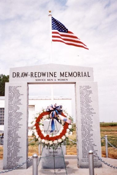
| Photo
courtesy Regina Crutcher, 2003 |
Draw-Redwine
Memorial
Photo courtesy Jimmie Crawford of Lubbock Texas
and Ethel Giles of Aurora Colorado, 8-2004 |
Draw-Redwine
Memorial
I am a grandson
of Truett and Ethel Mae Giles, who are Draw/Redwine natives (my Grandmother's
maiden name is Crawford). My Grandmother recently attended the dedication
service for the new Draw-Redwine Memorial and returned with some pictures
of the new memorial. She, along with her brother, were hoping to get
a picture of the memorial loaded onto your Draw, Texas page. - Attached
is the image of the memorial. - Ryan McIntyre, August 18 & 30,
2004 |
Draw, Texas
Forum
Thank you for
adding my "history" to the Draw page. Kudos to you for this website.
I find it especially moving that you would devote time and effort
to such an obscure (and mostly vanished) little burg as Draw, and
I express gratitude on behalf of all of us who once lived in or even
passed through that little hamlet and now years later find it embedded
in our fond memories.- Cordially, Nolan Porterfield, February 20,
2005 |
| Texas
Escapes, in its purpose to preserve historic, endangered and vanishing
Texas, asks that anyone wishing to share their local history, stories,
landmarks and vintage/historic photos, please contact
us. |
|
|