|
 |
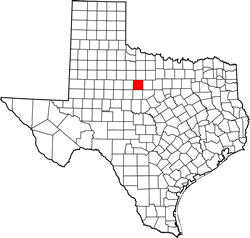
History in
a Pecan Shell
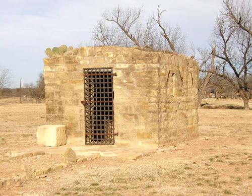
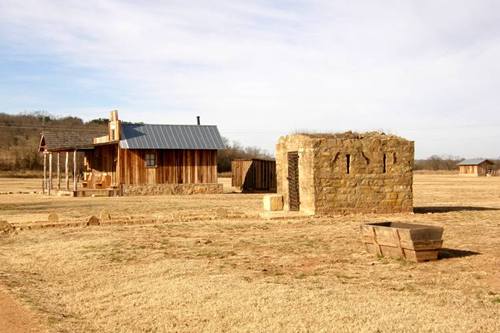
Remnants of the town are now protected as the Fort Griffin State
Historic Site. The town was situated between Fort Griffin and
the Clear Fork of the Brazos River, the water source for the facility.
Since the fort held the strategic hilltop, the town became known simply
as the Flat.
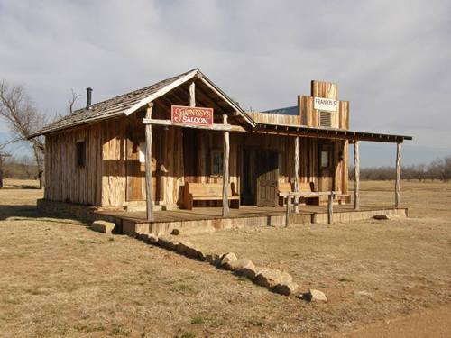
The town, even in ruins, retains its hard-won reputation for being
one of Texas� most lawless communities.
Populated (at one time or another) by many of the more colorful characters
of Western legend, the Flat had no municipal control since Shackelford
County had yet to be organized. The misbehavior in the Flat got
so out-of-hand that the commanding officer of Fort Griffin declared
martial law in the mid 1870s. Undesirables from the Flat were banished
to towns that were short of undesirables. With the riff-raff gone,
the county was organized in 1874. (See Vigilantes
were the law in frontier towns)
The roster of trouble-makers included Lottie
Deno, Big
Nose Kate, John
Wesley Hardin, John Selman, John M. Larn. Other famous names included
Pat Garrett, Doc Holliday, and his long-time friend Wyatt Earp.
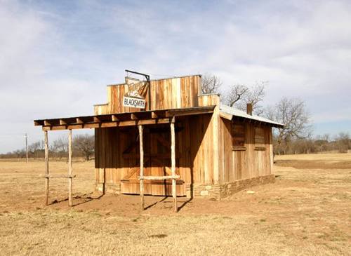
During the mid 1870s buffalo
hunters used the fort as a supply base. The Butterfield Stage route
passed the Flat (East-West) and cattle drives passed the town going
north.
The town peaked at 1,000 permanent residents � an enviable figure
for the times. Transients added to that number while the buffalo
roamed, but the population declined.
Albany started accommodating
the cattle herds that passed by and even the fort itself had its contingent
reduced. The Flat was hit with a double-whammy in 1881. Washington
closed the fort and the Flat was bypassed by the
railroad.
It did manage to hang on as a shadow of its former self (albeit a
well-behaved shadow) into the 20th Century but today the population
consists of park personnel.
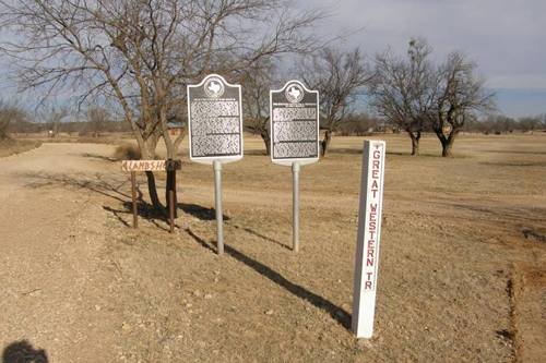
Historical Markers
Frontier
Town of Fort Griffin
The
Western Cattle Trail Crossings at Fort Griffin
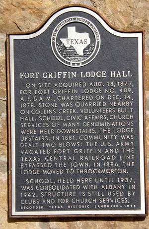
Fort
Griffin Lodge Hall
|
Fort
Griffin Lodge Hall Historical Marker
Photo courtesy Barclay
Gibson, February 2008 |
Fort Griffin
Historical Markers
|
Frontier Town
of Fort Griffin Historical Marker
US 283 and CR 184
Photo
courtesy Barclay
Gibson, February 2008 |
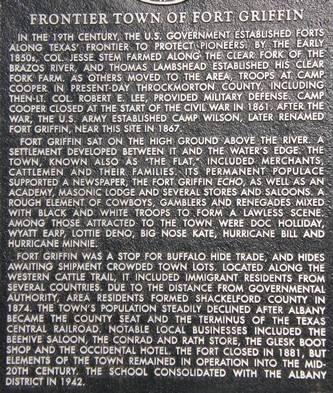
Historical Marker:
Frontier Town
of Fort Griffin
In the 19th century,
the U.S. government established forts along Texas' frontier to protect
pioneers. By the early 1850s, Col. Jesse Stem farmed along the Clear
Fork of the Brazos River, and Thomas Lambshead established his Clear
Fork Farm. As others moved to the area, troops at Camp Cooper in present-day
Throckmorton County,
including then-Lt. Col. Robert E. Lee, provided military defense.
Camp Cooper closed at the start of the Civil War in 1861. After the
war, the U.S. Army established Camp Wilson, later renamed Fort Griffin,
near this site in 1867.
Fort Griffin sat on the high ground above the river. A settlement
developed between it and the water's edge. The town, known also as
"The Flat," included merchants, cattlemen and their families. Its
permanent populace supported a newspaper, the Fort Griffin Echo, as
well as an academy, Masonic lodge and several stores and saloons.
A rough element of cowboys, gamblers and renegades mixed with black
and white troops to form a lawless scene. Among those attracted to
the town were Doc Holliday, Wyatt Earp, Lottie
Deno, Big
Nose Kate, Hurricane Bill and Hurricane Minnie.
Fort Griffin was a stop for buffalo hide trade, and hides awaiting
shipment crowded town lots. Located along the Western cattle trail,
it included immigrant residents from several countries. Due to the
distance from governmental authority, area residents formed Shackelford
County in 1874. The town's population steadily declined after
Albany became the county
seat and the terminus of the Texas Central Railroad. Notable local
businesses included the Beehive Saloon, The Conrad and Rath Store,
the Glesk Boot Shop and the Occidental Hotel. The fort closed in 1881,
but elements of the town remained in operation into the mid-20th century.
The school consolidated with the Albany
district in 1942. |
 |
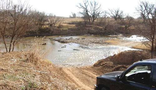
The Western Cattle
Trail Crossings at Fort Griffin
Photo
courtesy Barclay
Gibson, February 2008 |
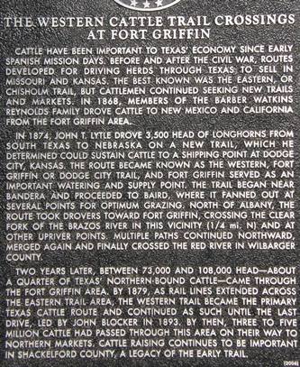
Historical Marker
The
Western Cattle Trail Crossings at Fort Griffin
Cattle have been important
to Texas' economy since early Spanish mission days. Before and after
the Civil War, routes developed for driving herds through Texas
to sell in Missouri and Kansas. The best known was the Eastern, or
Chisholm
Trail, but cattlemen continued seeking new trails and markets.
In 1868, members of the Barber Watkins Reynolds family drove cattle
to New Mexico and California from the Fort Griffin area.
In 1874, John T. Lytle drove 3,500 head of longhorns
from south Texas to Nebraska
on a new trail, which he determined could sustain cattle to a shipping
point at Dodge City, Kansas. The route became known as the Western,
Fort Griffin or Dodge City Trail, and Fort Griffin served as an important
watering and supply point. The trail began near Bandera
and proceeded to Baird, where
it fanned out at several points for optimum grazing. North of Albany,
the route took drovers toward Fort Griffin, crossing the Clear Fork
of the Brazos River in this vicinity (1/4 mi. N) and at other upriver
points. Multiple paths continued northward, merged again and finally
crossed the Red River in Wilbarger County.
Two years later, between 73,000 and 108,000 head--about a quarter
of Texas' northern-bound cattle--came through the Fort Griffin area.
By 1879, as rail lines extended across the Eastern Trail area, the
Western Trail became the primary Texas cattle route and continued
as such until the last drive, led by John Blocker in 1893. By then,
three to five million cattle had passed through this area on their
way to northern markets. Cattle raising continues to be important
in Shackelford
County, a legacy of the early trail. |
Fort Griffin
Related Stories
Robin
Hood of the Tonkawa by Charley Eckhardt
"Unlike many easterners who came to the Flat, stayed a few
days or weeks, then left, Robin Hood took to frontier life as though
born to it. The harder life got on the frontier, the better he liked
it. When the Comanches or Kiowas raided, he was the first in the
saddle in pursuit. Jacobs says ��he never knew when to quit.� That�s
extremely high praise from a man who grew up on the frontier."
more
The
Night Smoky's Hair Turned White by Mike Cox
Among the buffalo hunters and assorted hangers-on around Fort Griffin
in the late 1870s, almost anyone tough enough to survive could be
considered something of a character. But a loner named Smoky stood
out.
Edgar Rye, who met Smoky in 1877, first told his story in 1909 in
his long out of print book, "The Quirt and the Spur: Vanishing
Shadows of the Texas Frontier."
Smokey showed up at Fort Griffin -- then a wild and wooly town adjacent
to the military post that gave it is name ... more
Murder
Mystery at Fort Griffin by Mike Cox
Vigilantes
were the law in frontier towns by Delbert Trew
Fort
Phantom Hill - A sub-post of Fort Griffin in the early 1870s
Lottie
Deno: Queen of the Paste Board Flippers by Maggie Van Ostrand
James
Brock's Honesty of Purpose by Clay Coppedge
|
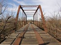
| Fort Griffin
area Bridges |
Fort Griffin
CR188 Low Water Crossing
Photo courtesy Barclay
Gibson, February 2008 |
A Conversation
With The Family...
(of Longhorns)
Photos courtesy
Barclay
Gibson, February 2008
Captions by someone else |
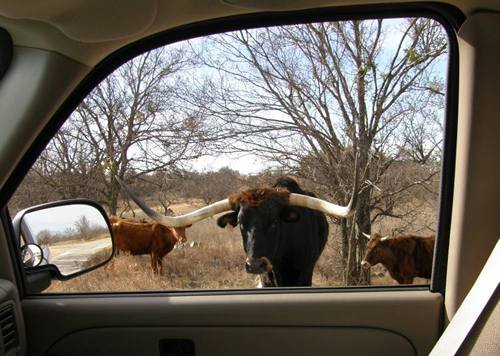
"Tell
me that's not beef jerky I see on your dashboard."
|
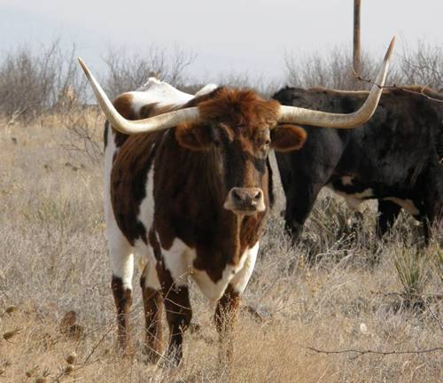
Trail drives?
We don't need no stinking trail drives!
|
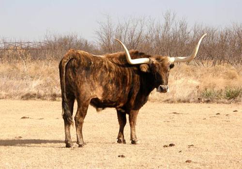
"...and
then I told him: "if you think I'm working one minue past
five, you're out of your mind."
|
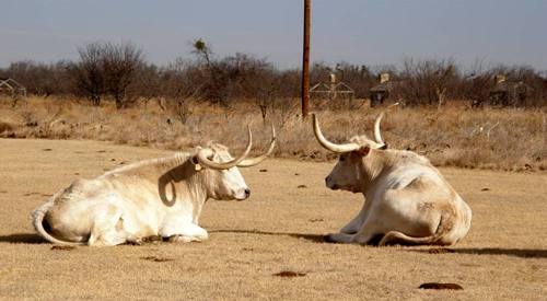
The forlorn
longhorn. Ostracized from the herd for a discouraging word?
|
Fort Griffin
Forum
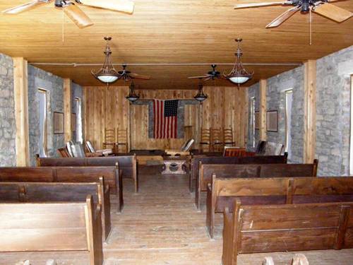
Subject: Fort Griffin Lodge Hall Flag
"...The flag is hanging backwards... See section 7 item j of
the United States Code Title 4 Chapter 1 � The Flag. j. When displayed
either horizontally or vertically against a wall, the union should
be uppermost and to the FLAG�S own right, that is, to the observer�s
left. When displayed in a window, the flag should be displayed in
the same way, with the union or blue field to the LEFT of the observer
in the street..." - Dwinn Ortiz, Administrative Assistant, Historic
Sites Division, Texas Historical Commission, February 12, 2009 |
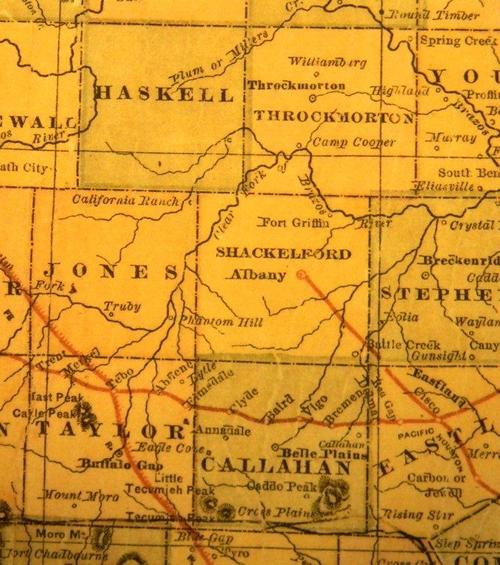
1882
map showing Shackelford
County, Fort Griffin & Clear Fork of the Brazos River
Courtesy Texas General Land Office |
Fort Griffin is included in "More Ghost Towns
of Texas" by T. Linsay Baker ›
Texas Escapes, in its purpose to preserve
historic, endangered and vanishing Texas, asks that anyone wishing
to share their local history, stories, landmarks and recent or vintage
photos, please contact
us.
|
| More
Ghost Towns of Texas |
|
|
|