|
Texas
| Counties
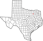
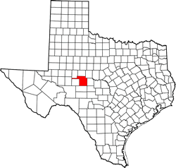
TOM GREEN COUNTY,
TEXAS
31� 24' 36"
N, 100� 27' 36" W (31.41, -100.46)
Population: 118,386 Est. (2016) 110,224 (2010)
Total area: 1,541 square miles (3,990 km2)
1,522 square miles (3,940 km2) land
19 square miles (49 km2) water |
|
|
 |
Tom Green County
History
Historical Marker
(on courthouse grounds):
ORIGINAL TOM GREEN COUNTY
On transcontinental trail of California Gold Rush. Until 1846 a part
of Bexar land district, Republic
of Texas. Private tracts were surveyed as early as 1847. German
Emigration Company colony (90 miles southeast) had grants here, but
in 1840s found Indians blocking settlement. Butterfield Overland Mail
managers lived at stands in area, 1858-61. R. F. Tankersley family
established a permanent home in 1864 in future Tom Green County. By
1874 there were five settlements here, including Bismarck farm, a
colony of 15 German immigrants. The county (12,756 sq. mil., 10-1/2
times as large as state of Rhode Island) was created in 1874 and named
for heroic Gen. Green (1814-64), a state official and gallant Texas
soldier. After a decade of progress, the original Tom Green County
began losing outlying areas. Midland
County -- halfway between Fort
Worth and El
Paso on newly opened Texas and Pacific railway -- was created
in 1885. Settlers remote from San
Angelo petitioned for new counties in 1887, and the Texas Legislature
created Crane, Loving,
Upton, Ward
and Winkler. Coke
and Irion Counties were cut out
of Tom Green in 1889. Ector and
Sterling were created in 1891.
Last diversions -- Glasscock
(1893) and Reagan (1903) --
gave Tom Green its present size. It remains influential in the region.
1972 |
Tom Green County
Town List
Cities, Towns &
Ghost Towns: History, attractions, landmarks, architecture, monuments,
museums, cemeteries, bridges, parks, vintage & contemporary images,
area destinations, hotels,
and forum.
County Seat - San
Angelo
Book Hotel Here -
San Angelo Hotels |
Tom Green
County Vintage Maps
|
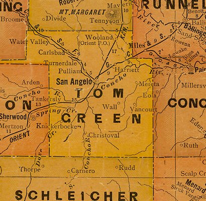
Tom Green County
1907 postal map
From Texas state map #2090
Courtesy
Texas General Land Office |
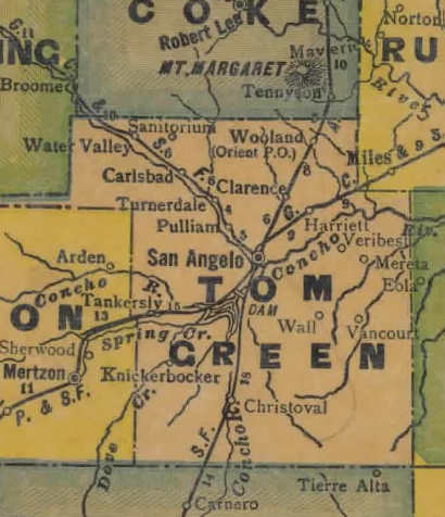
Tom Green County
1920s map
From Texas state map #10749
Courtesy
Texas General Land Office |
Tom Green County
1940s map
From Texas state map #4335
Courtesy
Texas General Land Office |
| Texas
Escapes, in its purpose to preserve historic, endangered and vanishing
Texas, asks that anyone wishing to share their local history, stories,
landmarks and vintage/historic photos, please contact
us. |
|
|

 Texas
Gulf Coast
Texas
Gulf Coast East
Texas
East
Texas Central
Texas North
Central
Texas North Central
Texas South
Central
Texas South Texas
Panhandle
Texas
Panhandle South
Texas
South
Texas Texas
Hill Country
Texas
Hill Country West
Texas
West
Texas Texas
Ghost Towns
Texas
Ghost Towns Texas
Counties
Texas
Counties