|
|
Texas�
state highways are some of the most interesting ways to travel. They
pass through�not go around�interesting
communities of every sort. The towns are both beautiful�sometimes
(and sometimes not so beautiful)�and often historically interesting.
The two longest state highways in Texas are Highway 16 and Highway
6. Both cut across scenic and historically significant parts of the
state.
Texas 16 branches off US 281 thirty-two miles south of Wichita
Falls�or seven miles south of Windthorst,
if you prefer. It finally terminates on the banks of Falcon
Reservoir, in Zapata,
on the Rio Grande. The first town it encounters is the community of
Loving, named for Oliver
Loving of the Goodnight-Loving trail. If you saw the TV mini-series
Lonesome Dove, the character of Gus was based on Oliver Loving.
Not far away is the headquarters of the famous JA ranch, once owned
by John Adair, one of the founders of what is now the Texas & Southwestern
Cattle Raisers Association. The JA ranch was the original headquarters
of that organization.
Just off the road to the east is the site of the Warren
Wagon Train massacre, one of the worst incidents in the Texas
Indian wars. Seven teamsters were murdered in a particularly horrible
manner by a band of Kiowas from the Fort Sill Reservation, led by
a warchief usually called Setank or Satank. His name, pronounced phonetically,
is closer to Set-An-Gay. Literally, it means �Bear Pushes With Its
Feet,� which is usually shortened to Kicking Bear.
In a confrontation straight out of a John Wayne movie, Setank and
two of his subchiefs were arrested at Fort Sill and extradited to
Texas to stand trial. Before the wagon carrying him got off Fort Sill
Setank tried to escape�or may have been trying to get killed rather
than face �white-man justice.� He was shot and killed by his guards.
The other two were tried in Jacksboro for the murders of the teamsters.
Both were sentenced to hang. One committed suicide in prison by leaping
headfirst from a third floor window onto a stone-paved courtyard.
The other converted to Christianity, was eventually pardoned, and
became a Methodist missionary among his people. The actual instigator
of the massacre, a medicine man called Owl Prophet, was never prosecuted.
South of Loving the road
goes through the town of Graham.
Graham is a jewel�one
of the prettiest towns in Texas. It�s also centered in an oil patch,
and there�s no pretty way to enter the town. Every approach road is
lined with oil-field equipment yards. Don�t miss Graham�s
downtown park. It�s a real beauty.
Near Graham is Ft. Belknap
State Park. Ft. Belknap,
one of the string of frontier forts established in Texas, was extremely
prominent during the Indian Wars. It was from Ft. Belknap that General
Phil Sheridan departed for Fort Richardson, near Jacksboro,
on the same day the Warren wagon train was attacked. Sheridan�s wagons
used the same route as the Warren train, and passed the ambush site
while the Kiowas lay in wait. Owl Prophet told Setank �There will
be two wagon trains to pass. Do not attack the first. It would be
very bad to attack the first. You may attack the second safely.�
At approximately the time Sheridan�s wagons were passing the ambush
site, he said to his aide �I don�t see what these Texans are complaining
about. We haven�t seen a single Indian sign this whole trip.� Late
that evening a Warren survivor staggered into Ft.
Richardson with the news of the massacre.
South of Graham the road
skirts the north and east edges of Possum
Kingdom Lake. The fishing there is said to be outstanding, and
scuba divers have reported catfish of gargantuan proportions in the
deepest parts. According to one I talked to, a catfish he saw ��could
have swallowed a Volkswagen and it wouldn�t have made a bulge.� |
|
|
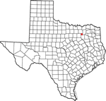
The
smokestack in Thurber
TE photo, 2001 |
| |
 |
Below Possum
Kingdom the road meets�and follows�US 181 for a short distance, then
turns south again. At Strawn
take a side trip to the east on Spur 108 to Thurber
to see the Thurber tipple. Thurber,
once a thriving community, was the site of a coal mining boom in the
early years of the 20th Century. The great wooden coal tipple is about
all that�s left of Thurber.
Back on 16, the next town you encounter is Desdemona,
once called Hogtown. Take a look at the old Desdemona jailhouse. It�s
worth seeing.
South of Desdemona,
at De Leon,
16 crosses 6, the other �longest state highway in Texas.� South
of De Leon
is Comanche.
Have a look at the big
oak tree on the courthouse square�Uncle
Mart�s Tree, it�s known locally. You�ll find a local to tell you
the story behind it. It was in Comanche
that 21-year-old John Wesley Hardin killed Brown
County Deputy Sheriff Charlie Webb, his last-known killing. It
was the only Hardin killing out of somewhere between 44 (my count)
and 51 (his count) that couldn�t, after Reconstruction
ended, be justified as self-defense. It was also the only one Hardin
himself said he regretted.
South of Comanche
the road passes through Priddy
and Goldthwaite
and into San
Saba. San
Saba, besides being known as �The Pecan Capitol of Texas,� is
the burial place of Sion Record Bostick. Never heard of him? Sion
Bostick was one of the �five young Texans� who found a �Mexican private�
cowering in a creekbed after San
Jacinto. The �Mexican private� was none other than Antonio
Lopez de Santa Anna y Perez de LeBron, President of Mexico. |
 |
South of San
Saba the road passes through some mighty pretty country, through
the tiny town of Cherokee,
and into Llano,
the �Deer-Hunting Capitol of Texas.� There�s a lot more than deer
hunting to Llano County,
including the location of La Cueva de San Jose del Alcazar,
the original Lost San
Saba Mine. Take a side trip down Texas 71�another long highway�and
look on the east side of the road for the historical marker just after
you cross Honey Creek. After you read it, go down a piece to where
Click Road branches off to the west. Stop there and look west. The
mountain in front of you, today known as Riley Mountain, is the original
Cerro del Almagre or �hill of red hematite.� Look in the saddle
of the mountain for two large liveoaks. At the foot of those two trees
is the original Lost San Saba Mine shaft, today called �Boyd shaft.�
A little farther down the road you�ll cross Sandy Creek. You can,
if you�re absolutely determined, actually recover gold from Sandy
Creek. It�s flour gold�as fine as grains of flour�and before electronic
concentration the only way to recover it was to amalgamate it with
mercury and then boil the mercury off. Not only would inhaling the
mercury fumes kill you, you�d spend more on the mercury than the gold
would be worth.
Farther down 16, just out of Fredericksburg,
you�ll pass Enchanted Rock.
If you happen to be there after a series of very hot days and camp
at the park, if a norther blows in that night you�ll hear where it
got its name. The rock is made up of a series of layers, sort of like
a huge granite onion. The outer layers expand with heat, and when
suddenly cooled�like a norther hitting after a series of hot days�it
gives off some of the most ghastly, unearthly groaning sounds you�ll
ever hope to hear as the outer layer, contracting in the cold, scrapes
against the inner layers of rock. Most of the creeks in the area also
yield tiny garnets and sapphires for the rockhound�but don�t do your
rockhounding in the state park. It�s illegal.
Fredericksburg
needs no introduction. The home of the Nimitz
Museum of the Pacific War, it is home to some of the most interesting�and
rare�exhibits of that conflict. One is a pair of panties and a brassiere
crocheted from string scavenged off Care packages sent to the nurses
who were captured when the Philippines fell. The Sunday House Caf�
has some of the best wurst in Fredericksburg,
and it also stocks Doppelspaten��Double Shovel,� a German beer
so dark it makes brown foam when you pour it. It�s brewed according
to the Bavarian purity law�all it can contain is water, yeast, malt,
and hops�and the brewery�s been in business since before Christopher
Columbus�s great-grampaw was born.
South of Fredericksburg
the road goes through Kerrville,
another town that needs no introduction. Home of the famous YO ranch
and Schreiner College, now Schreiner University. Kerrville
was also once home to the state�s tubercular sanitarium. The high,
dry climate of Kerrville
was considered ideal for putting tuberculosis into remission.
South of Kerrville
at the crossing of the upper Guadalupe River, you go down one of the
last �Model T� roads in the state. In coming off the bluff to the
bridge below, the road is a series of switchbacks. These were necessary
in the days of Model T and Model A Fords, since neither had an oil
pump. Both depended on �splash oiling,� like a modern lawnmower. At
the end of each switchback a Model T or Model A driver would stop
and rev his engine several times to make sure enough oil splashed
up into the cylinders and on the bearings that the next switchback
could be climbed or driven down without burning up the engine.
A side trip down Spur 173 will take you to Camp
Verde, once home to the US
Army�s Camel Corps. Only one of the original buildings stands
today. Once the camp headquarters, it is today a private residence.
The chimney is dated and marked �Pis� Work.� That�s not a misspelling
of �Piece Work.� �Pis� is French for adobe.
FM 2828, which leaves Spur 173 just south of Camp
Verde, will take you through some very pretty country and join
16 just south of Medina.
In Medina
there is a house of particular interest. It was designed by General
John Bell Hood�Commander of Hood�s Texas Brigade, CSA.
Southeast of Medina
you encounter Bandera,
�The Cowboy Capitol of Texas.� There�s an interesting old museum there,
but mostly, these days, Bandera
is home to what were once called �Rexall Rangers��drugstore cowboys.
That doesn�t mean it didn�t have a rootin�, tootin�, shootin� past,
though.
From Bandera
the road goes through Pipe
Creek and Helotes
and into San Antonio.
South of San Antonio
the road goes due south in an almost straight line for nearly 150
miles. It passes through Poteet,
�The Strawberry Capitol of Texas,� where the water tower is painted
to look like a giant strawberry. Poteet
is home to a Strawberry Festival every spring. The next town is Jourdanton,
where a lot of the old cattle trails began to join up. The cowboy
statue in Jourdanton
is interesting.
South of Jourdanton
you enter what�s known as �The Free State of McMullen.� McMullen
County is one of the few counties, if not the only county, in
the US which does not take and has never taken federal subsidies of
any kind. The county seat is Tilden,
once known as Dogtown.
Tilden came by its
new name in 1876. Samuel J. Tilden, former New York Governor, founder
of the New York Public Library, and the 1876 Democratic candidate
for President, actually won the popular vote. The electoral vote was
tied, which threw�by law, at least�the election into the US House
of Representatives, a body dominated by Radical Republicans. In a
series of machinations probably understood fully only by God, the
Radicals disrupted the election process and Rutherford B. Hayes was
inaugurated. This was known as �The Crime of �76,� and the people
of Dogtown renamed
their town for the man who won the vote but was denied the presidency.
From Tilden it�s
a long way�41 miles, to be exact�to Freer, and there�s nothing out
there. You�ve heard of �miles and miles of Texas?� This is where it�s
brought home to you with a vengeance. You�re in the brasada�the
brush country of South Texas.
The ranches are big and the side-roads few. In fact, you�ll find only
two side-roads on your Texas map. You will, however, cross the Nueces
River.
Freer is in Duval
County, which once had an evil reputation. It was the domain of
George B. Parr, �The Duke of Duval.� Parr has an evil reputation outside
Duval County, but
if you ask the ordinary people in Duval
County, you�ll hear a different story. While George B. treated
the Duval County treasury as his own personal checkbook�Duval
County once bought $40,000 worth of snow-removal equipment because
George B. got a sizeable kickback from the seller�nobody went hungry
in Duval County if
el Patr�n heard about it. Don�t have enough money to give your
daughter a proper quincea�era? El Patr�n will see to
it she has her quincea�era. Got a son or daughter who�s smart
enough to go to college but you can�t afford it? Talk to el Patr�n.
Many a Duval County
youngster got a far better education than the family could afford,
thanks to el Patr�n. Far from being a parasite like many �political
bosses,� George B. Parr was something entirely different and far older.
He was �el Patr�n.�
Another 39 miles of brasada�make sure you have plenty of gas,
because there�s nothing but miles and miles of miles and miles between
Freer and Hebbronville�will
bring you into the heart of the South
Texas oil patch. Between Hebbronville
and Zapata
things get a mite more interesting. You�ll pass through�or by�three
almost-ghost towns. They are Randado, Escobas,
and Bustamante. The latter two contain some interesting buildings.
The few residents of Escobas
and Bustamante, for the most part, speak only Spanish. It�s best to
photograph the buildings� exteriors and leave exploration of the interiors�even
the abandoned ones�alone. The final 55 mile stretch from Hebbronville
to Zapata
brings you to the shores of Falcon
Reservoir. In the lake�sometimes visible if the water is very
low�are the ruins of �old
Zapata,� the original town the lake covered when it was built.
� C. F.
Eckhardt
"Charley Eckhardt's Texas"
March 3 , 2008 column |
| Texas
Escapes, in its purpose to preserve historic, endangered and vanishing
Texas, asks that anyone wishing to share their local history, stories,
and recent or vintage/historic photos, please contact
us. |
|
|